T-45A UJPT & E2-C2 INav-01
Review of FLIP and Publications
All United States Airports depicted on the high altitude charts have a minimum of 5,000 ft of hard surface
runway. The VFR airports do not have an instrument approach procedure and are depicted in BROWN.
Airports depicted in GREEN and BLUE have an instrument approach procedure; however, the DOD FLIP
(Terminal) High Altitude Instrument Approach Procedure booklets contain approach procedures only for
those airports depicted in BLUE.
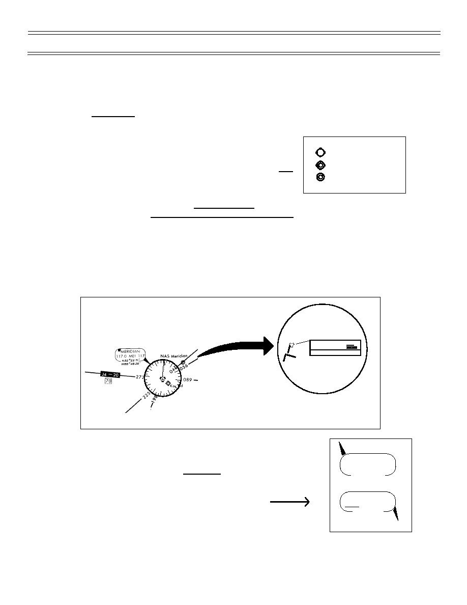
The airport symbol indicates the type of airport. If the name of that
airport is contained with parentheses, it is without military landing
Civil
rights, i.e., you must have prior coordination to use that airport and you
Civil Military
may be charged landing fees. In case of EMERGENCY, however, ALL
Military
depicted airfields are available. Airfields may be offset from their actual
location to accommodate the location of NAVAIDs.
Those NAVAIDs with compass roses are enroute NAVAIDs used to
define the jet routes and are not necessarily associated with any airport. An airport may or may not utilize
that NAVAID, and you should always refer to the appropriate approach procedure chart to determine the
correct NAVAID for an approach.
EXAMPLE: On the enroute chart, MERIDIAN VORTAC, Channel 117 is used to define the jet routes;
whereas, NAS Meridian uses TACAN Channel 56 for instrument approach procedures and it is not
depicted on the enroute chart.
MERIDIAN
Chan 56 NMM
N32 34.70' W88 32.71'
NAVAID communication boxes contain VOR, TACAN, and Radio Beacon data.
Some VOR and Radio Beacon facilities have voice capability; however, if the
MEMPHIS
117.5 MEM 122
frequency is underlined, this indicates NO VOICE. All TACAN facilities are
N35 03.76'
without voice but are not underlined.
W89 58.90'
BIGBEE
116.2 IGB (L) 109
N33 29.13'
W88 30.82'
(6-99) Original
Page 1-32


 Previous Page
