T-45A UJPT & E2-C2 INav-01
Review of FLIP and Publications
MINIMUM CROSSING ALTITUDE (MCA) is depicted at a fix by a flag box
containing an “x.” Depicted is the jet route number, crossing altitude, and a
X
direction of flight.
AUGER
It is the lowest mean sea level altitude at which a fix must be crossed when
J70
proceeding in the direction of a higher MEA. In the event of a radio failure
25000W
when a higher altitude assignment has not been received, climb must be
commenced in order to cross the fix at or above the crossing altitude and
climb continued to the MEA for that segment.
CAUTION: Climb must be commenced early for obstruction clearance.
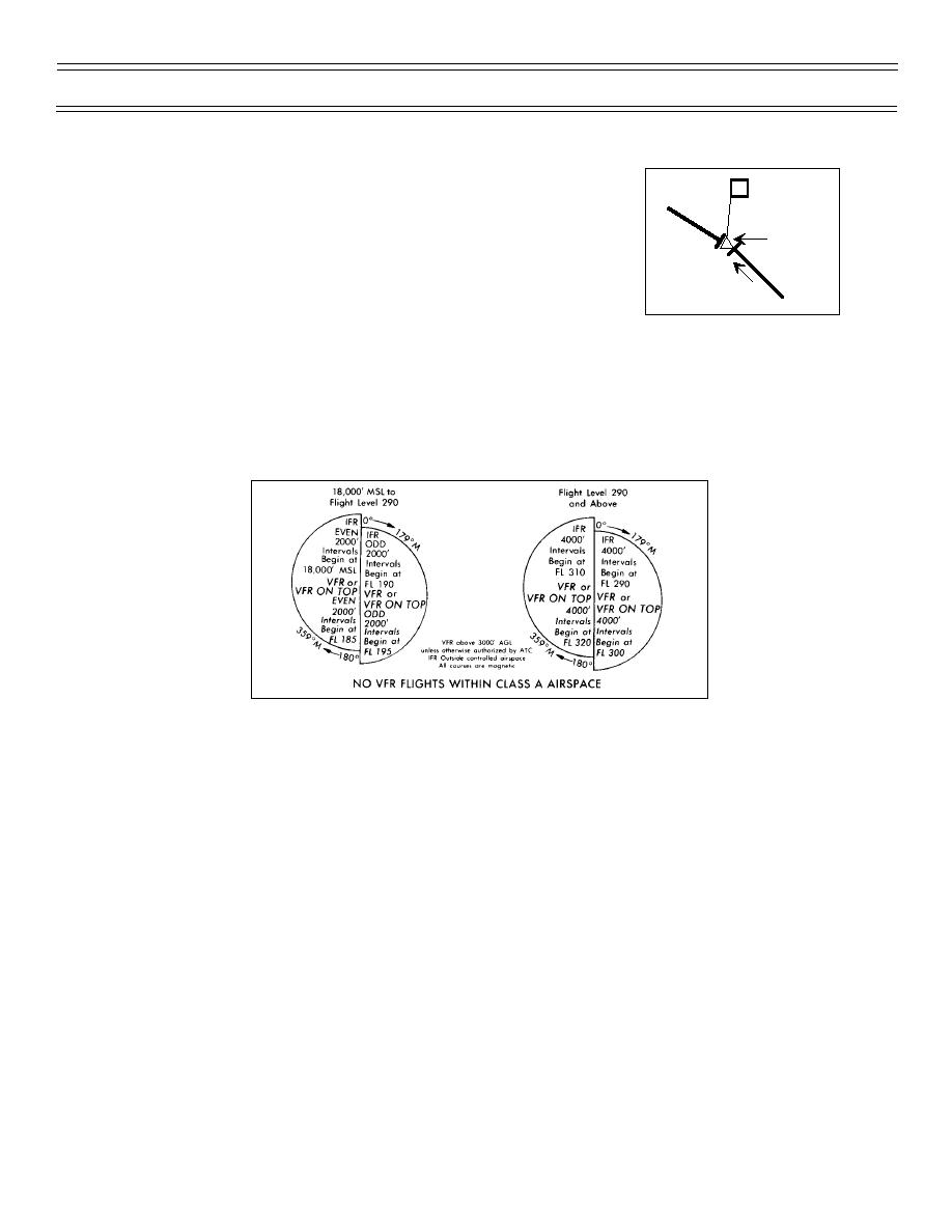
You should file at or above the highest MEA and at or below the lowest MAA along your planned route
using the international cruising altitude rules legend.
For an IFR flight plan:
Odd thousands East and Even thousands West to FL 290
4,000 ft intervals East beginning at FL 290
4,000 ft intervals West beginning at FL 310
NOTE: The legend depicts VFR altitudes above 18,000 ft MSL because they are ICAO rules and the U.S.
is a provider state. As indicated in the legend, however, VFR operations are not allowed above 18,000 ft
over the continental U.S.
Airspace depicted in WHITE signifies CONTROLLED AIRSPACE, and airspace depicted in BROWN
shade signifies UNCONTROLLED AIRSPACE. The only uncontrolled airspace on the High Altitude
Charts are Prohibited areas, some warning areas, and some restricted areas - which are of two types:
1. Restricted areas in white indicate “Joint Use” areas and controlled airspace. Permission to enter
these areas can be obtained in the air directly from the appropriate ARTCC; and,
(6-99) Original
Page 1-30


 Previous Page
