 |
|||
|
|
|||
|
Page Title:
Here are the points used for the strip charts |
|
||
| ||||||||||
|
|  WEAPONS
glued together in such a manner as to make it easier to use in the aircraft. If planning a X/C you
may fly a different route. Also, be sure to have EFR, MCF and Joker fuel. Cross "Bingo" off the
doghouse stamp and write in "Joker." On the divert chart, be sure to have the bingo fuel for each
point as well as a heading and distance to the nearest divert. (Colored arrows are preferred).
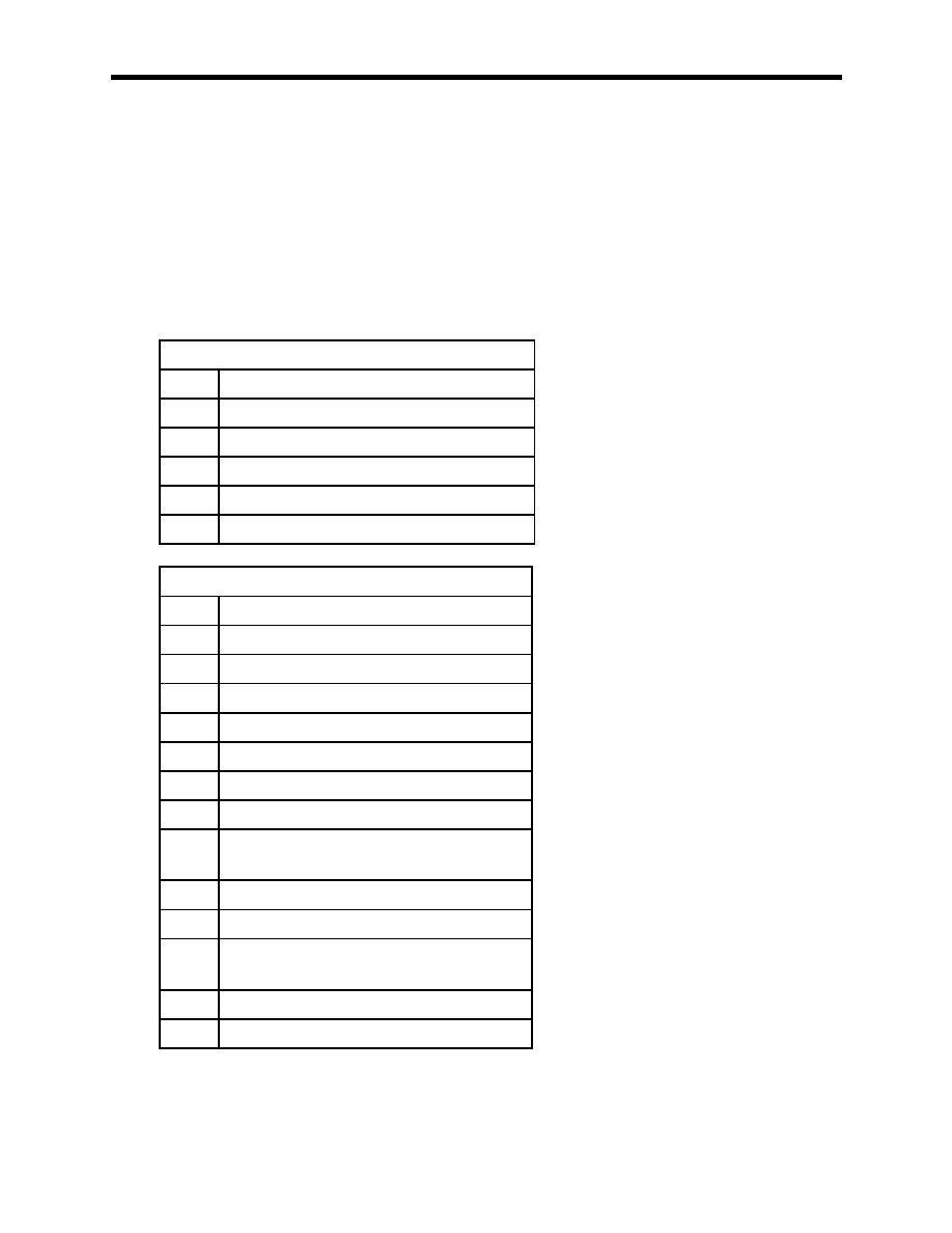
3.24.2. Here are the points used for the strip charts. The LLs are flown at 500 feet AGL, 300
KIAS utilizing 60-90 degrees AOB. Turn radii are only required on turns of 120 or greater.
Lat/Longs for all points are listed in the FLIP Military Training Routes. WEPS 1/2 are normally
flown on the VR 1024 as an out and in to NAS Meridian. If weather precludes this, the VR 1021
is flown twice. Both charts are required at brief time, and are turned in to the IP after the event is
flown.
VR 1021
Point Description
A
Tip of peninsula
B
Highway bridge over small river
C
Power plant (South end)
D
Abandoned mine on river
E
RR trestle over creek
VR 1024
Point Description
A
Tip of peninsula
B
Highway bridge over small river
C
Wiggins Dam
D
RR Trestle over creek
E
T-Section, 1 mile west of fire tower
F
Town of Goss
G
Town of Mt. Olive
H
RR / Road X-Section north of Bay
Springs
I
Town of DeSoto
J
Road bridge over river
K
Fire tower (burned down ironically, so
turn on time)
L
Town of Deer Park
M
RR bridge over river
3-12
|
|
Privacy Statement - Press Release - Copyright Information. - Contact Us |
