 |
|||
|
|
|||
|
|
|||
| ||||||||||
|
|  T-45C TS INav-01
Review of FLIP and FAA Publications
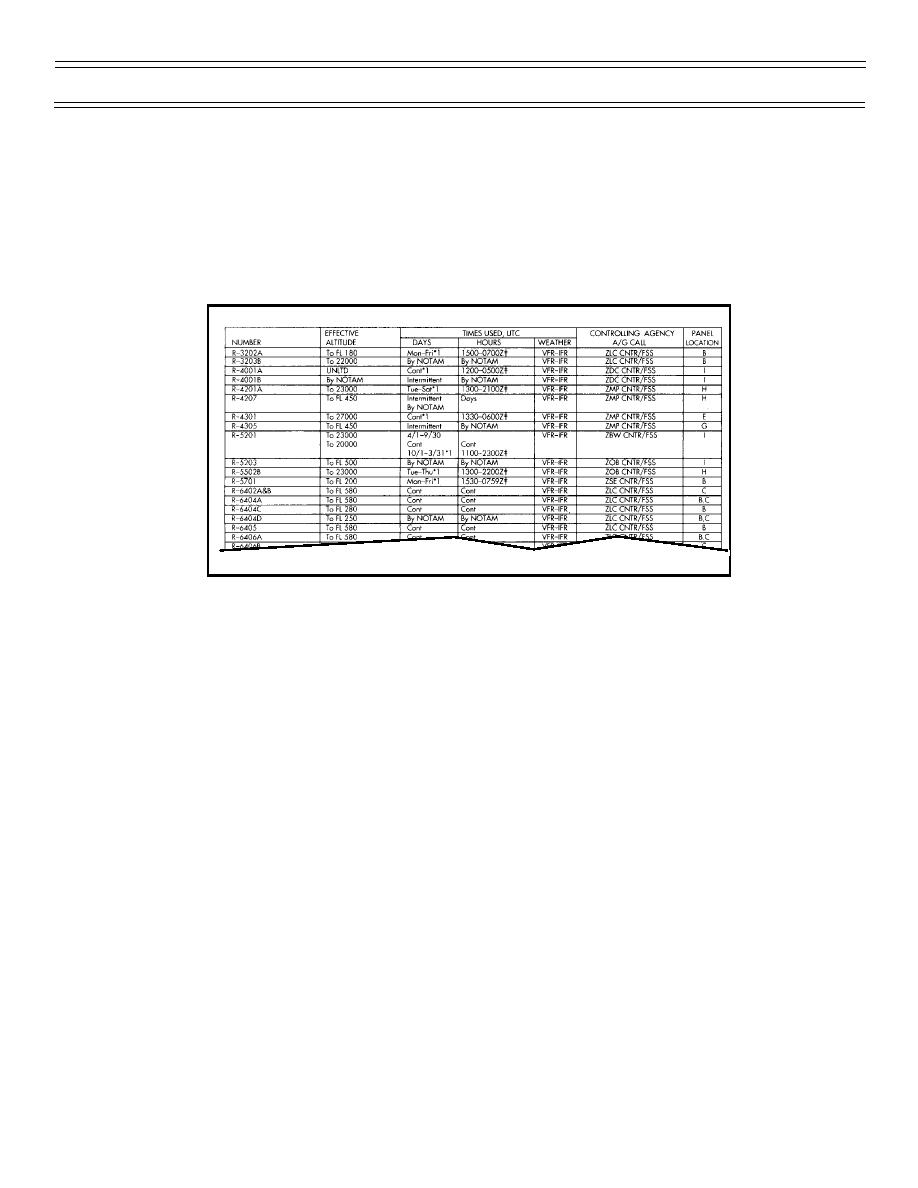
2. Restricted areas in brown shade indicate “Non-Joint Use” areas and uncontrolled airspace without
communications support (No A/G). Permission to enter these areas must be obtained from the using
agency (listed in AP/1A) prior to flight.
Pertinent information concerning special use airspace will be found on the outside panels of the respective
charts.
NOTE: Only those special use areas that extend up to or above 18,000 ft MSL will be depicted on the FLIP
IFR Enroute High Altitude Charts.
Magnetic variation is used in flight planning to align your flight computer to true North in order to obtain an
accurate ground speed from the forecast true winds aloft. Variation is depicted every 4 degrees on the
charts by North-South oriented thin SOLID GREEN LINES which are labeled along the top and/or bottom
edges of the charts. You should interpolate for an approximate variation in a particular area.
For flight information purposes, official time zones are depicted on the charts by North-South oriented
DOTTED GREEN LINES.
Standard units of measurement used on the high altitude charts provide for direct application in the aircraft.
Altitudes: MSL
Mileage: Nautical
Radials/Bearings: Magnetic
Times: Universal Coordinated (Z)
Days: Local
Page 1-28
(2-02) Original
|
|
Privacy Statement - Press Release - Copyright Information. - Contact Us |
