 |
|||
|
|
|||
|
|
|||
| ||||||||||
|
|  CHAPTER SEVEN
FLIGHT TRAINING PUBLICATION (FLIP) STUDENT GUIDE
NOTE
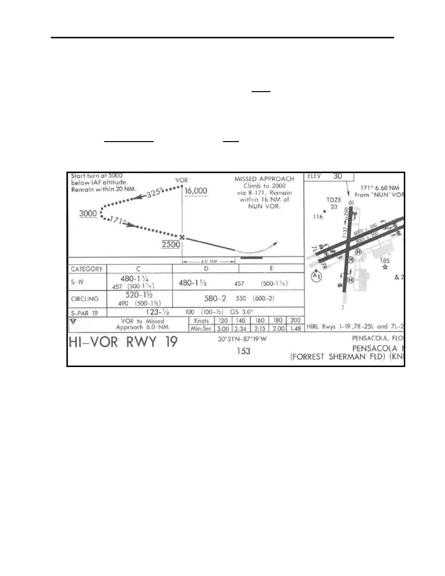
VOR or NDB Approach Procedure Charts, for those procedures
predicated on a radio aid which is located away from the field,
contain an addition to either the Minimums Section or Airport
Sketch. The procedure is flown without DME, therefore the
Missed Approach Point will be determined by elapsed time after
crossing the FAF. The additional section is a table based on
ground speed for determining the time to the MAP. Procedures
with the VOR or NDB at the field do not have a FAF and thus do
not have this table (Figure 7-28).
Figure 7-28 HI-VOR RWY 19
Airport Diagrams
The FLIP High and Low Altitude Approach booklets contain detailed diagrams for those
airfields that support operations of aircraft equipped with Inertial Navigation Systems (INS).
The coordinate values are shown in one-minute increments; they are further broken down into
six-second ticks, within each one-minute increment. Information such as runway length, width,
magnetic heading, weight bearing capacity, taxiway location and identification, and spot
coordinates is provided. See the example in Figure 7-29.
7-34
TERMINAL PUBLICATIONS
|
|
Privacy Statement - Press Release - Copyright Information. - Contact Us |
