 |
|||
|
|
|||
|
|
|||
| ||||||||||
|
|  INSTRUMENT NAVIGATION
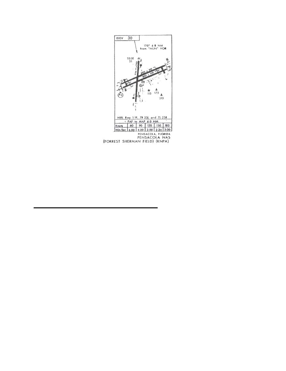
Figure 7
Note the "FAF to MAP" timing at the bottom of the airport sketch. This table is used to
determine the time to the missed approach point from the Final Approach Fix at various ground
speeds. Ground speed must be estimated. Example: With an approach speed of 120k and 15k
of headwind, ground speed becomes 105k with timing (Figure 7) of 3:30.
LOW ALTITUDE INSTRUMENT APPROACHES
Introduction - An instrument approach enables an aircraft to transition from instrument flight
conditions to a visual landing while providing terrain clearance and separation from other
aircraft. There are a number of low altitude instrument approach procedures which may be
executed with the navigation equipment in the T-34C. These include procedure turn, teardrop,
holding pattern, straight-in, and arc and radial combination approaches which use VOR, DME,
TACAN or a combination thereof to define the approach. Radar vectors to final approach course
is an additional procedure which may be applied to any of the above approaches.
Procedure
1. Prior to departure familiarize yourself with the destination instrument approach
procedures (IAP's) compatible with aircraft navigational aids. Check forecast weather
conditions against weather minimums listed on the approach plate and choose a suitable
alternate. Enroute, review the approach procedures and check the destination ATIS.
2. Determine whether the duty runway requires straight-in or circling minimums, then
compare current weather and the weather minimums for the approach. The T34-C is considered a
single-piloted aircraft. Therefore, you may not commence an instrument approach if either
7-10
INSTRUMENT DEPARTURES AND APPROACHES
|
|
Privacy Statement - Press Release - Copyright Information. - Contact Us |