 |
|||
|
|
|||
|
|
|||
| ||||||||||
|
|  CHAPTER FOUR
METEOROLOGY FLIGHT PLANNING
406.
PART I: MISSION/TAKEOFF DATA SECTION
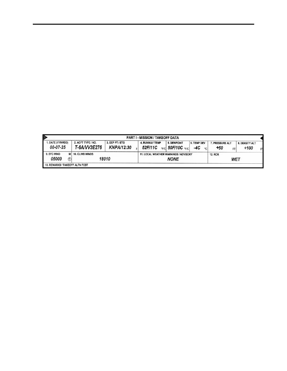
The briefer uses the data from the DD 175 to complete the Mission/Takeoff Data section of the
DD 175-1. This section identifies the flight for which the form is being prepared (first three
blocks) and the forecast conditions for takeoff and climb out. Completion of the remaining
takeoff data blocks is not normally required unless the pilot or person receiving the brief
specifically states this information is needed or desired. However, local weather warnings that
apply to the takeoff airfield, such as a CAWW or MWA, are always entered. This type of entry
consists of the name of the warning and time that the warning is valid (e.g., TSTM COND II
until 13Z). Although they are not required, the remaining blocks are usually filled in with data
gathered from TAFs, FDs, and weather warning sources. Notice in Figure 4-3 that data from the
DD 175 appears in Part I. The date, aircraft type, and departure point correspond with the flight
plan submitted to METRO.
Figure 4-3 Part I: Mission/Takeoff Data Section
407.
PART II: EN ROUTE DATA SECTION
The En Route Data section of the DD 175-1 provides space for information about expected
weather conditions within a range of 25 nautical miles of the intended route, and 5,000 feet above
and below the intended flight path, plus destination conditions at altitude. (Note: 25 nautical miles
and 5000 feet are guidelines onlyeach mission is briefed on any phenomena that could occur,
considering aircraft capability, mobility, versatility, and mission variations.) To avoid confusion
among the various boxes in this section, briefers generally use different indicator marks to correlate
entries, such as the club and diamond symbols in blocks 22 and 24 of Figure 4-4. Also, an up
arrow (↑) indicates conditions during the climb, and a down arrow (↓) relates to the descent.
4-6 FLIGHT WEATHER BRIEFING FORM, DD FORM 175-1
|
|
Privacy Statement - Press Release - Copyright Information. - Contact Us |