 |
|||
|
|
|||
|
Page Title:
Information Sheet: Chart Projections, Plotting and Global Time Keeping |
|
||
| ||||||||||
|
|  INFORMATION SHEET
Chart Projections, Plotting and Global Time Keeping
Information Sheet No. 4.2.1I
INTRODUCTION
This information sheet introduces the student to the most widely used air navigation charts,
and explains that these charts are essential tools for effective air navigation. This
information sheet will also introduce the student to the global timekeeping system that will
aid in understanding and coordinating navigation problems.
REFERENCE
INFORMATION
CHART PROJECTIONS
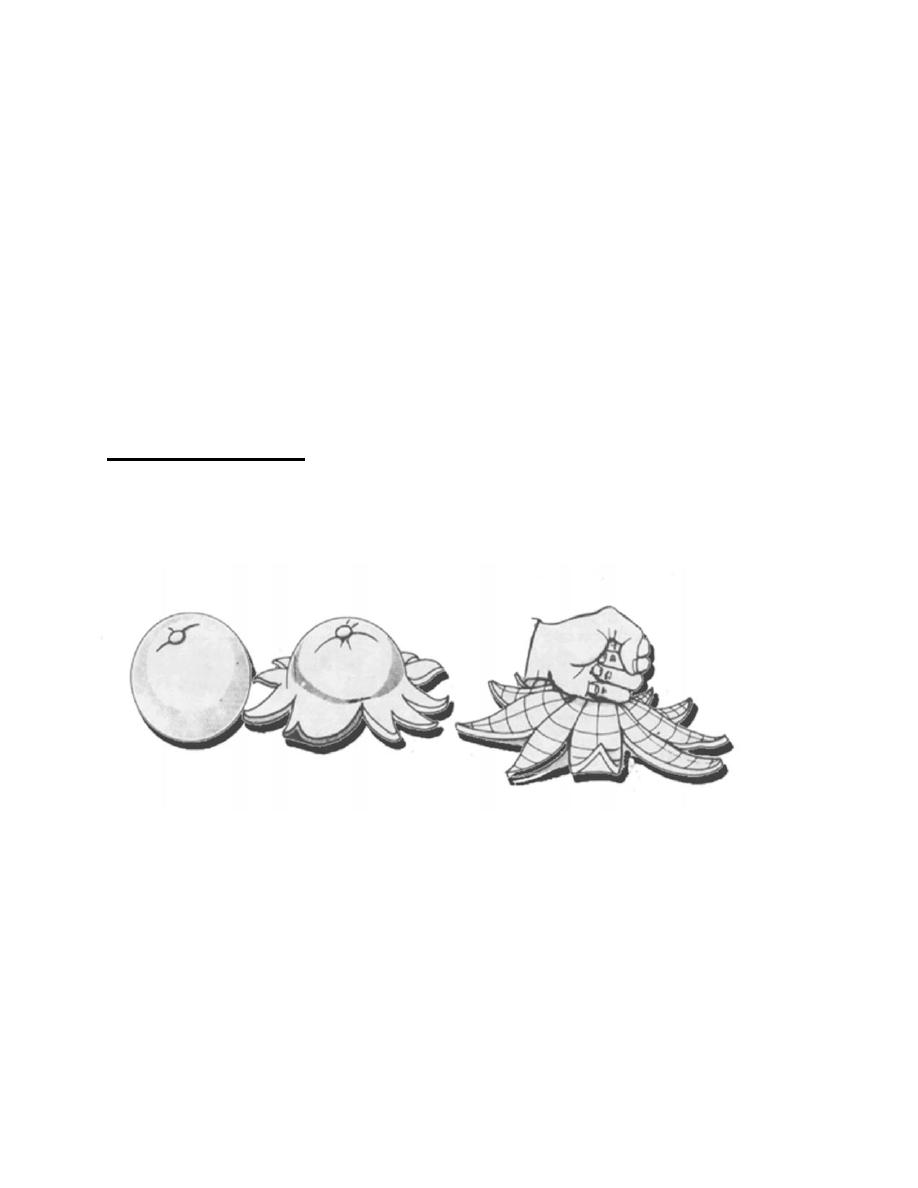
Because the earth is a sphere, it cannot be flattened and still maintain the integrity of the
surface. Therefore, a sphere is an undevelopable surface. Figure 4.2-1 shows the results
of such an attempt.
Figure 4.2-1 Undevelopable Surface
A chart is a small-scale representation of the earth's surface. No chart can be entirely
accurate in its representation since it is a two-dimensional piece of paper and the earth is a
three-dimensional sphere. Some distortion is always present, but it can be minimized.
Charts are projected on surfaces that can be flattened without stretching or tearing, such
as a cone. This surface is called a developable surface.
4.6-21
|
|
Privacy Statement - Press Release - Copyright Information. - Contact Us |
