 |
|||
|
|
|||
|
Page Title:
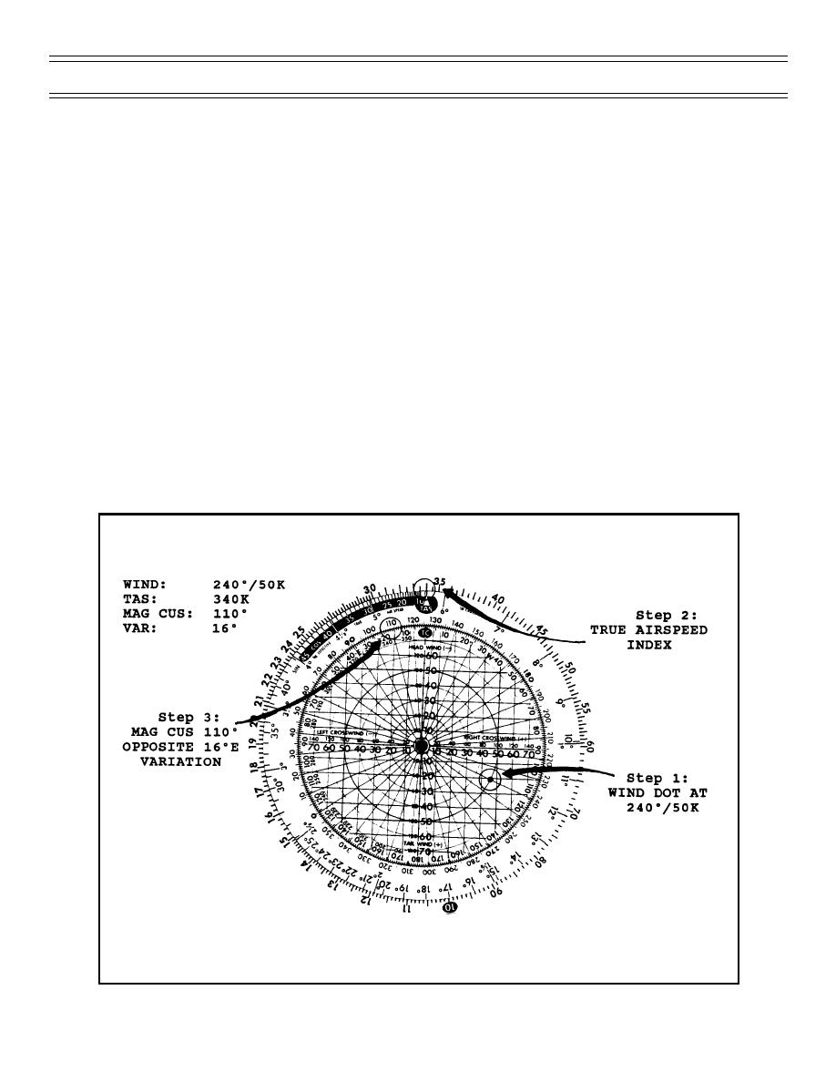
Figure 4. Computing Ground Speed with Crab Angle Less Than 10 Degrees (part 1) |
|
||
| ||||||||||
|
|  T-45C TS INav-08
Fuel, Weather, and Alternate Airfield Planning
You will be primarily working with the FLIP Enroute High Altitude Charts which depict radials (courses) in
degrees magnetic. These are the radials you set in the course selector of the HSI. You will fly a
magnetic heading on your HSI to make good the course, or track-over-the-ground, you have selected.
Therefore, in flight planning, if you are faced with TRUE WINDS and MAGNETIC COURSES, it is
obvious something has to be done to make them compatible.
The circular computer solves this by providing a magnetic-true conversion scale on either side of the
True Course (TC) index. From the FLIP Enroute Charts, you obtain your desired Magnetic Course and
also the Magnetic Variation in the area. By setting the Magnetic Course on the “Degree Scale” over the
Variation (East or West), the wind dot is automatically aligned to use the True Winds Aloft which you
received from the forecaster. You use this method for each leg to compute groundspeeds for each leg of
flight.
NOTE: Lines of Magnetic Variation are depicted at 4 degree intervals. You should interpolate between
lines to obtain the approximate variation in your area of flight or an alternate method would be to look at a
field diagram in the area of flight.
Examples:
1.
Computing ground speed with crab angle less than 10 degrees - You obtain the following
information to complete one leg of flight on the Jet Flight Log:
GIVEN:
TS
TAS
E
OPPOSITE 340 KTAS
TS
Figure 4 (Part 1): COMPUTING GROUND SPEED
WITH CRAB ANGLE LESS THAN 10 DEGREES
(2-02) Original
Page 8-15
|
|
Privacy Statement - Press Release - Copyright Information. - Contact Us |