 |
|||
|
|
|||
|
|
|||
| ||||||||||
|
|  STUDENT GUIDE
VISUAL NAVIGATION
6.5.6.2. In T-34 VNAV chart
preparation, the altitude for each
leg is placed in the appropriate
information box or "dog house."
For T-1A/T-39 charts, the
altitude listed in the information
box shall be a `safe' MSL
altitude for that leg. Compute
this altitude by adding 500 feet
to the highest Maximum
Elevation Figure (MEF)
affecting that leg. Examine the
plotted track for a given leg,
determine which latitude -
longitude blocks the leg crosses,
and choose the highest MEF of
those "blocks" the route crosses.
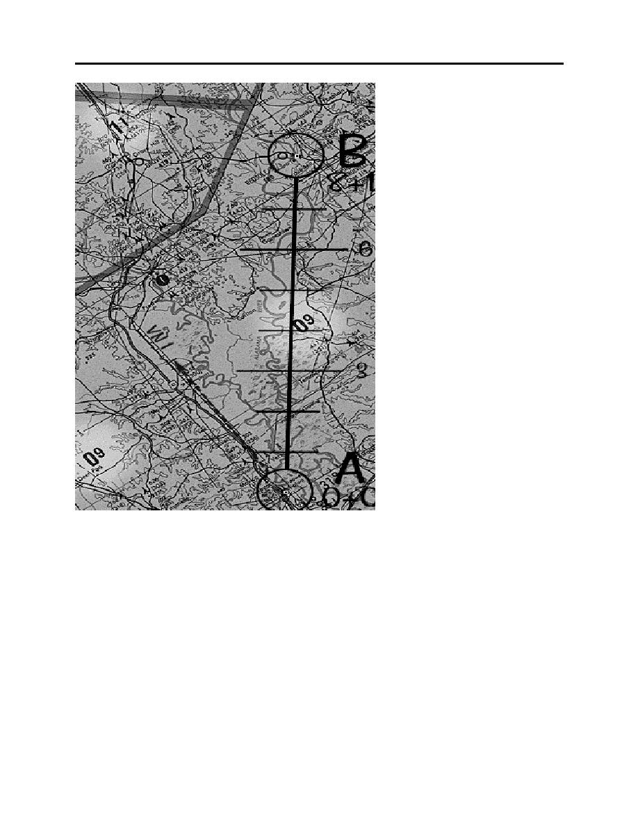
6.5.6.3. In Figure 6-8, there are
three MEF values to consider:
1100 feet, 900 feet,and 900 feet
(note high lighted areas). The
highest of these is 1100 feet, so
another 500 feet is added to
yield 1600 feet. Record this
altitude in the information block
for this leg, as well as the data
work sheet.
Figure 6-8
NOTE: This is just an emergency altitude--- when this route is flown, the aircraft will descend
to 500 feet AGL or the lowest AP-1B altitude, which ever is higher.
6-11
|
|
Privacy Statement - Press Release - Copyright Information. - Contact Us |
