 |
|||
|
|
|||
|
|
|||
| ||||||||||
|
|  STUDENT GUIDE
VISUAL NAVIGATION
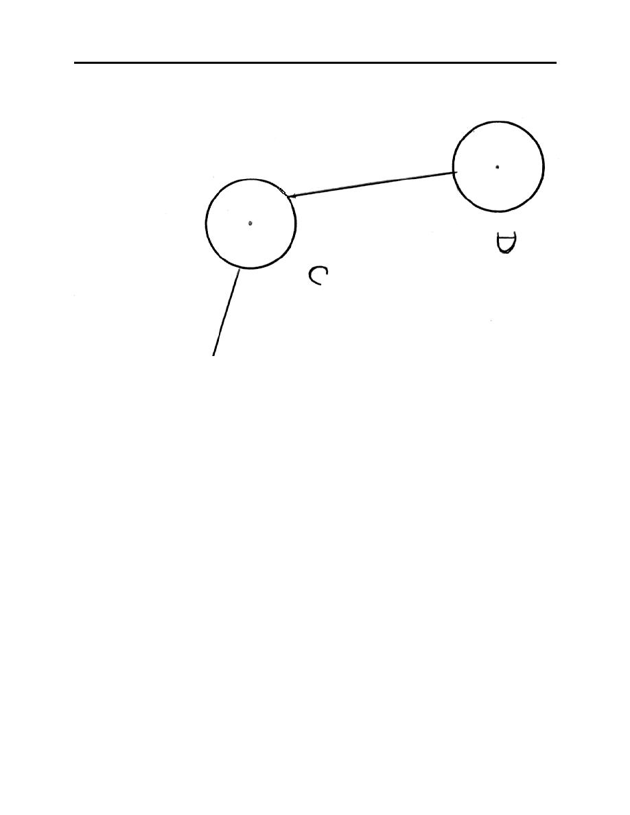
Figure 6-7
6.5.4.7. After the course line is in place, erase the excess turn radius markings so the final result
is a smooth turn depiction. Whether a dime or template plotter is used, the result should be the
same as illustrated in figure 6-7.
6.5.5. Measuring Course
6.5.5.1. Measure the true course for each leg along the plotted course line using the same
technique as used for T-34 VNAV charts. Apply magnetic variation to obtain the magnetic
course, remembering that east variation is subtracted from true course, and west variation is
added. Record these courses in the data table as was done for T-34 VNAV charts.
6.5.6. Selecting the Appropriate Altitude
6.5.6.1. T-1A/T-39 visual navigation within established low-level routes is based on flying AGL
altitudes rather than MSL altitudes. Typically, the low-level routes are flown at 500 feet AGL or
the lowest AP-1B allowed altitude, whichever is higher. The 500-foot minimum restriction
comes from OPNAVINST 3710.7 Sect. IV and AETC instructions, but a higher prescribed
altitude in AP-1B takes precedence. For example, if AP-1B dictates the route altitude structure
from point A to point B is 300 to 1500 feet AGL, then that leg is flown at 500 feet AGL. If,
according to AP-1B, the minimum route altitude is 700 feet AGL, then the route is flown at 700
feet AGL.
6-10
|
|
Privacy Statement - Press Release - Copyright Information. - Contact Us |
