 |
|||
|
|
|||
|
Page Title:
Figure 6-3 Military Training Routes |
|
||
| ||||||||||
|
|  FLIGHT TRAINING PUBLICATION (FLIP) STUDENT GUIDE
CHAPTER SIX
The heading in Figure 6-2 contains some very useful information. The letter "L" across the top
should prevent you from mistaking the chart for a High Altitude Chart. The arrows on either
Side indicate that if you open the chart to the left, you will be looking at L-18, to the right, at
L-17. This heading shows the chart is for use up to but not including; 18,000 feet MSL. Perhaps
the most important information shown is the effective dates between which the chart is to be
used. Never fly with an out of date chart.
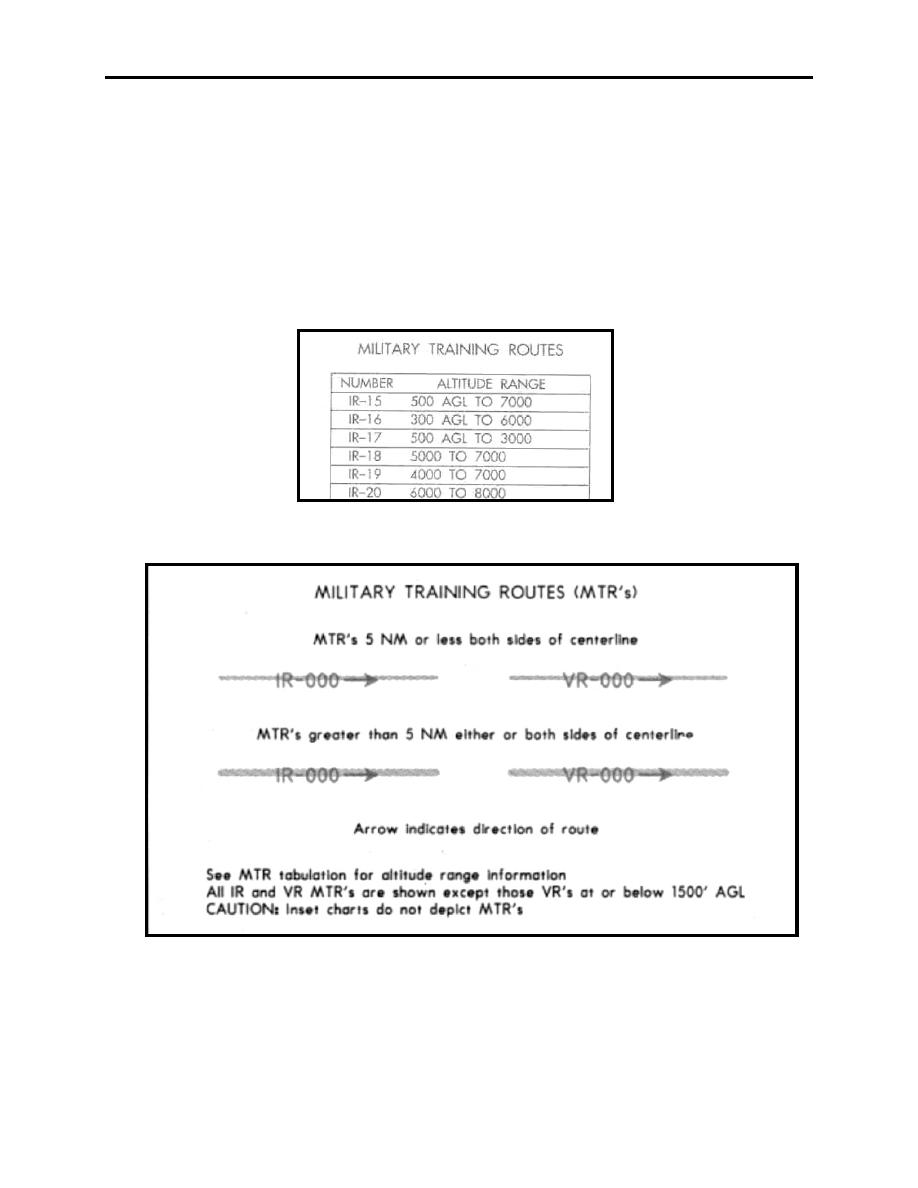
On the front panel is a table of Military Training Routes. Only those MTRs with altitudes above
1500 feet AGL will be listed. An example is shown below with an accompanying explanation
from the legend (Figures 6-3 and 6-4).
Figure 6-3 Military Training Routes
Figure 6-4 Military Training Routes
ENROUTE LOW ALTITUDE AND AREA CHARTS
6-3
|
|
Privacy Statement - Press Release - Copyright Information. - Contact Us |
