 |
|||
|
|
|||
|
Page Title:
Figure 2-4 Preferred Routes - High Altitude |
|
||
| ||||||||||
|
|  CHAPTER TWO
FLIGHT TRAINING PUBLICATION (FLIP) STUDENT GUIDE
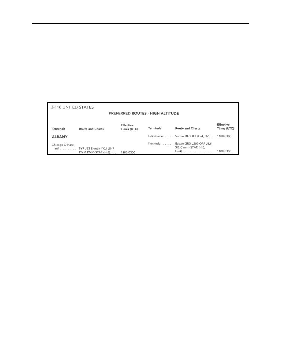
Some preferred routes may terminate with a "STAR" description. This "STAR" description is an
abbreviation for STANDARD TERMINAL ARRIVALS. At selected airfields the pilot is to
refer to the STAR publication that corresponds with the destination airfield.
NOTE
There are Preferred IFR Routes established for both the Low and
High Altitude Route Structures. Do not mistake one for the other.
An example of a high altitude preferred route originating in the
Albany area is shown in Figure 2-4.
Figure 2-4 Preferred Routes - High Altitude
VOR Receiver Checkpoints
A list of VOR facilities is available for operation checks of VOR equipment airborne.
Designated Mountainous Areas
These charts depict the designated mountainous areas in a theater of operations. The
significance of these areas will be discussed in FLIP 6.
203. AREA PLANNING 1A
(North and South America)
This section of FLIP planning contains a tabulation, by country and then numerically, of all
Prohibited, Restricted, Danger, Warning and Alert Areas. Additionally, Parachute
Jumping Areas and Military Operations Areas (MOAs) are listed. This section is published
for preflight planning purposes. Much of the same information on MOAs and Special Use
Airspace can be found on your FLIP Enroute Charts.
Legend
The student should be familiar with the legend and the definitions listed below.
2-6 AREA PLANNING 1, 1A, AND 1B
|
|
Privacy Statement - Press Release - Copyright Information. - Contact Us |
