 |
|||
|
Page Title:
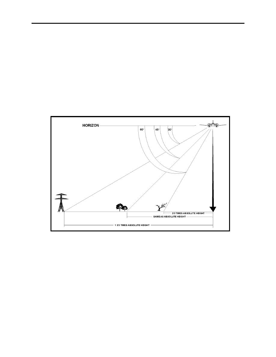
Figure 1-7 Estimating Distance by Angles Below the Horizon |
|
||
| ||||||||||
|
|  LOW-LEVEL AND TACTICAL FORMATION
CHAPTER ONE
Military operations require the analysis of contour-labeled charts to visualize the land. In
operational planning, this is of the utmost importance, whether it is planning a route for a safe
flight or determining the best escape route from enemy territory. In pilot training, you may use
roads and towns as checkpoints.
6.
Estimating Distances. After you have positively identified the checkpoint, you may have
to estimate your distance from it. Learning to judge distances comes mainly through experience.
Here are some techniques you can use:
If a checkpoint is 45 below the level of the horizon, the distance from the aircraft position on
the ground to checkpoint is equal to your altitude above ground (AGL). Other angles and
approximate distances are shown in Figure 1-7.
Figure 1-7 Estimating Distance by Angles Below the Horizon
You may also estimate distances by first measuring the distance between two checkpoints on the
chart. Use this reference as a guide for estimating other distances. For example, in Figure 1-8,
towns A and B are measured on the chart to be 10 miles apart. You are about twice that distance
from town A (or about 20 miles). Some parts of the country have section lines spaced
approximately 1 mile apart. To determine a distance, simply count the section lines.
LOW-LEVEL NAVIGATION 1-21
|
|
Privacy Statement - Press Release - Copyright Information. - Contact Us |
