 |
|||
|
|
|||
|
Page Title:
Figure 3-2 Road Intersection/Bridge Over River |
|
||
| ||||||||||
|
|  T-6A NAVIGATION
CHAPTER THREE
4.
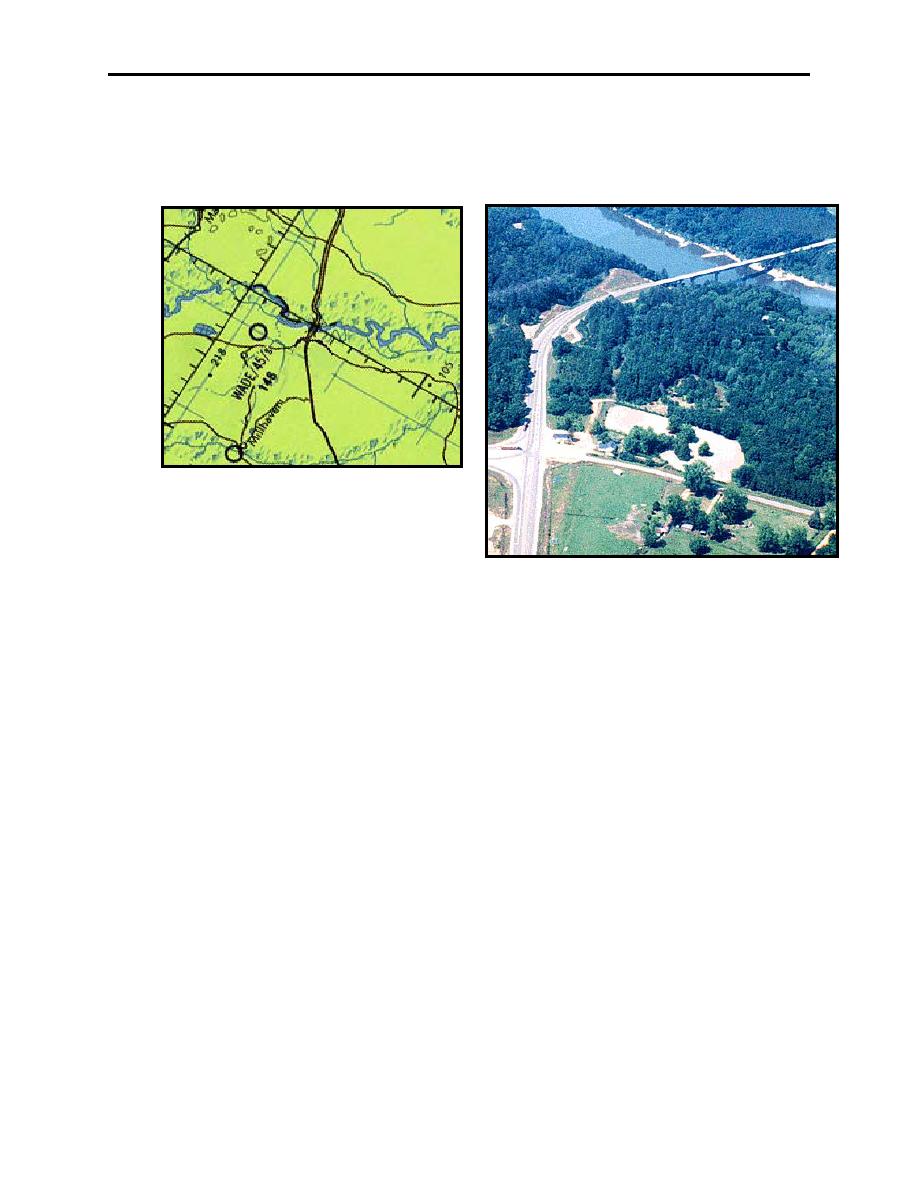
Look for other features identifying the checkpoint, such as terrain, river bends, roads, etc.
In this manner, a small distinct checkpoint can be verified as the correct point. In Figure 3-2,
note the road intersection prior to the bridge ensures you have the correct turnpoint.
Figure 3-2 Road Intersection/Bridge Over River
302.
MISSION RELATED CONSIDERATIONS FOR CHOOSING CHECKPOINTS
While aspects of the actual turnpoint are critical, there are also important mission related factors.
These include the altitude to be flown, visibility, mission pacing and aircraft type.
The altitudes flown in the T-6A make horizontal development more desirable than vertical
development. In a T-1 or T-39 at 500 feet AGL, towers "rise" above the horizon, so the angle of
view makes them easier to spot and identify.
Visibility is also related to altitude, as it affects the visible distance to the horizon. Typically, do
not choose checkpoints more than 3 NM from planned course line. Points greater than 3 NM are
difficult to identify and judge position from. Ideally, choose points as close to course as possible.
Mission pacing requires an appropriate amount of distance between checkpoints. Typically, this
distance is never less than one minute, and ideally greater than three minutes to enable accurate
wind analysis.
Because of turnpoint procedures performed on each low level leg, avoid choosing intermediate
checkpoints two minutes prior to or one and a half minutes after a turnpoint. Ideally, we choose
at least one intermediate checkpoint per leg. However, if the leg is short or if no prominent
feature is available, that leg may not have an intermediate checkpoint.
VISUAL FIXING 3-3
|
|
Privacy Statement - Press Release - Copyright Information. - Contact Us |