 |
|||
|
|
|||
|
|
|||
| ||||||||||
|
|  T-6A NAVIGATION
CHAPTER TWO
212.
PLOT AND ANNOTATE CONTROLLED AIRSPACE
In addition to applying CHUM information, annotate Class B, C, and D airspace.
Class D airspace extends from the surface to 2500 AGL, but the configuration is individually
tailored, generally having one concentric five statute-mile diameter circle centered about the
primary airport. Chart this in the same manner as depicted on the VFR sectional chart, with a
dashed blue line.
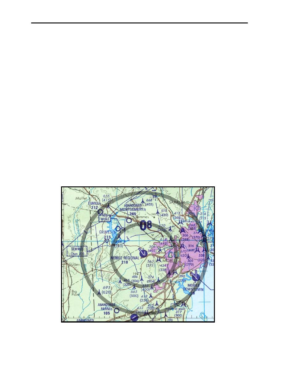
Class C airspace is standard in size with two concentric five and ten mile diameter circles
centered about the Class C airport. The airspace extends vertically from the airport surface up to
4000 feet AGL in the inner circle and from 1200 to 4000 feet AGL above the airport surface in
the outer circle. Airports having Class C airspace are listed in both Aeronautical Information
Manual (AIM) and AP-1 and depicted on low altitude enroute and VFR sectional charts. Figure
2-11 shows the Class C airspace for the Mobile Regional area.
Class B airspace is also listed in the same publications but they are non-standard in size and
shape. Your best sources of information for Class B airspace dimensions are the low altitude
enroute and VFR sectional charts.
To annotate airspace on your chart, outline the defined airspace in pencil, then after double
checking against a VFR sectional chart, apply blue ink, and include the altitude structure of the
airspace, adjusted to MSL.
Figure 2-11 Class C Airspace
LOW-LEVEL CHART PREPARATION
2-11
|
|
Privacy Statement - Press Release - Copyright Information. - Contact Us |