 |
|||
|
|
|||
|
|
|||
| ||||||||||
|
|  STUDENT GUIDE
VISUAL NAVIGATION
formal Military Training Routes (MTRs) as defined in AP-1/B. Flying Visual Routes (VR)
allows the sorties to be flown at speeds over 250 kts and altitudes down to 500 feet AGL.
MTR's also provide a
degree of safety with
respect to aircraft
separation and airspace
coordination. Figure 6-
1 lists the most common
routes flown by both
VT-10 and VT-4. The
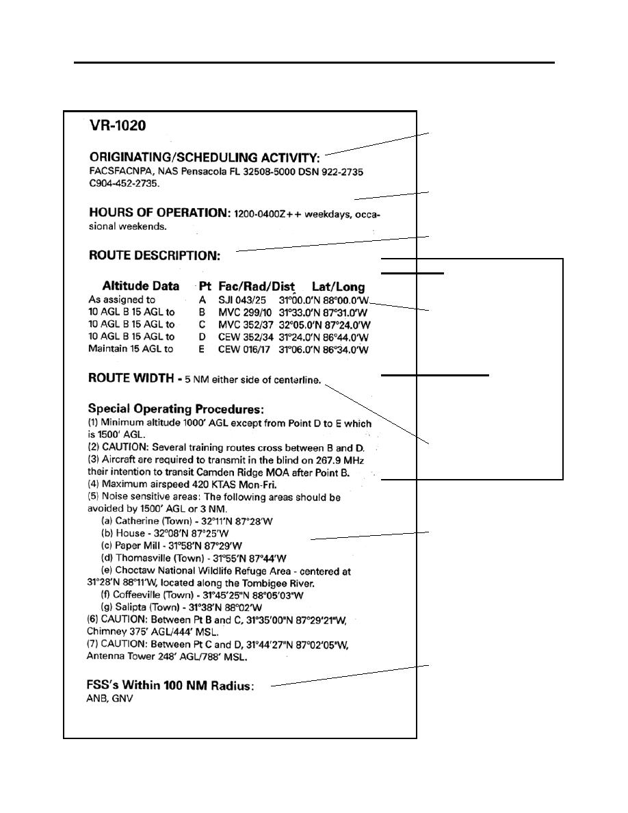
listing in figure 6-2
describes the various
T-1A/T-39 LOCAL LOW-LEVEL ROUTES
A.
VR - 1020 (A-E) Primary Route for VNAV 5
B.
VR - 1021 (A-E) Primary Route for VNAV 6
C.
VR - 1022 (A-F) Primary Route for VNAV.7
D.
VR - 1023 (A-G) Primary Route for AVX 2
TYPICAL T-1A/T-39 NON-LOCAL LOW-LEVEL ROUTES
A.
VR - 151 (C-J) Primary WX Alternate to the west (Texas)
B.
VR - 1040 (A-H) Primary WX Alternate to the east (Charleston)
C.
VR - 1632 (A-G) Primary WX Alternate to the north (Ohio)
D.
VR - 1006 (G-N) & (K-Q) Alternate southeast low-levels (S. Florida)
Figure 6-1
data found in AP-1B
and includes data
regarding the
dimensions of the route
as well as operating
procedures, restrictions
and hazards. Attach a
copy of each route's
current AP-1/B listing to
the back of the low-level
chart along with a data
worksheet. Students are
required to draw all
local charts plus the VR-
151 and the VR-1006
routes.
Figure 6-2
6-3
|
|
Privacy Statement - Press Release - Copyright Information. - Contact Us |