 |
|||
|
|
|||
|
|
|||
| ||||||||||
|
|  CHAPTER SIX
FLIGHT TRAINING PUBLICATION (FLIP) STUDENT GUIDE
Legend
A complete chart legend is shown on the back panel. It has been subdivided into four categories
of information:
1.
Airports,
2.
Radio Aids to Navigation and Communication Boxes,
3.
Air Traffic Services and Airspace Information, and
4.
Special Use Airspace.
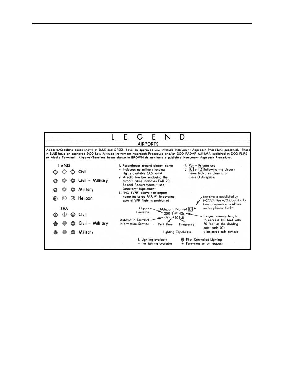
The Airport Category is shown in Figure 6-5. Study it carefully.
Figure 6-5 Airports
The RADIO AIDS TO NAVIGATION AND COMMIUNICATION BOXES legend is similar to
the High Altitude Chart legend, with some exceptions. NAVAID boxes are more rectangular.
Without classification the NAVAIDs will be assumed "H" category. ILS localizer frequencies
are depicted when the approach procedure defines a fix. Localizer identifiers consist of four
letters starting with the letter "I" (Figure 6-6). Flight Service Stations are shown by a heavy
lined NAVAID identification box, as shown by the Gainesville identification box (Figure 6-7).
When the FSS is not associated with a NAVAID, a separate heavy lined box will be depicted
(Figure 6-8).
6-4
ENROUTE LOW ALTITUDE AND AREA CHARTS
|
|
Privacy Statement - Press Release - Copyright Information. - Contact Us |