 |
|||
|
|
|||
|
Page Title:
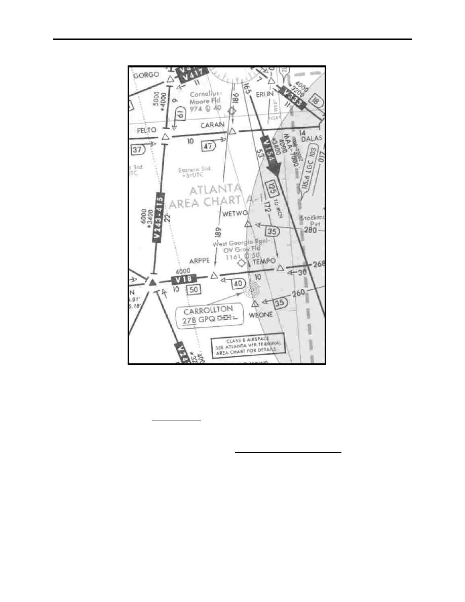
Figure 6-20 Atlanta Area on the Low Chart |
|
||
| ||||||||||
|
|  CHAPTER SIX
FLIGHT TRAINING PUBLICATION (FLIP) STUDENT GUIDE
Figure 6-20 Atlanta Area on the Low Chart
There are two Area Charts (A-1, A-2), printed on one sheet, which are issued every 56 days to
coincide with the issue, in time and date, of the FLIP Enroute Charts (Figure 6-21 ). These
charts contain detailed enlargements of 13 selected high activity terminal areas, including some
NAVAIDs, intersections, etc., not shown on the enroute charts. These charts do not contain a
legend since they use the same symbology as the Enroute Low Altitude Charts. On the chart
outside cover is printed a limited Airport Directory with communications frequencies listed for
airports depicted on the chart. This is a handy reference when operating in a high-density area.
The Area Charts are "blow-ups" of the areas and are usually drawn to a scale of five or six miles
to an inch. An Area Chart depicts the same enroute information that is provided on the Low
Altitude Chart. In addition, it provides more terminal information such as radar availability,
location and frequency of ILS localizer courses, NAVAIDs, etc., that may not be shown on Low
6-14
ENROUTE LOW ALTITUDE AND AREA CHARTS
|
|
Privacy Statement - Press Release - Copyright Information. - Contact Us |
