 |
|||
|
|
|||
|
|
|||
| ||||||||||
|
|  INSTRUMENT NAVIGATION
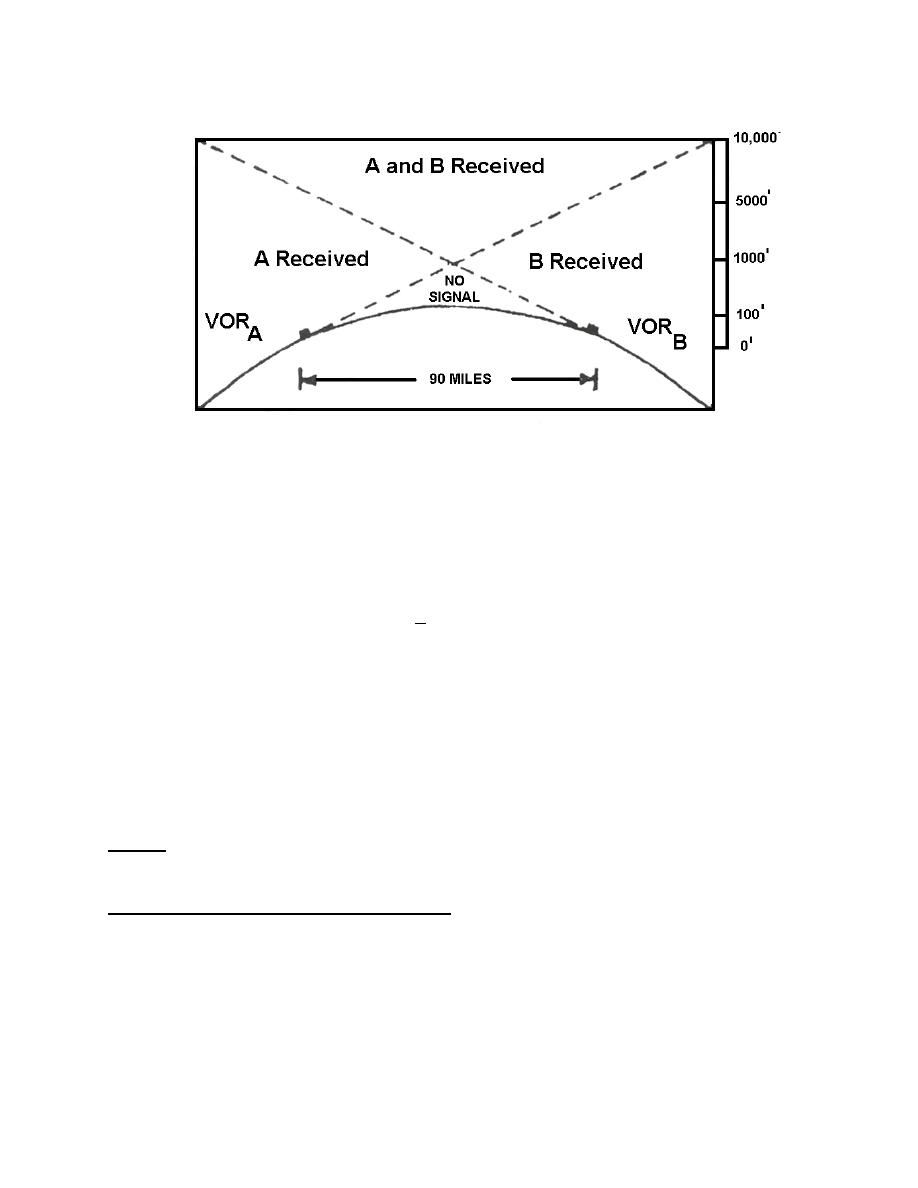
Figure 6
The curvature of the earth will sometimes be a limiting factor in VOR reception, especially
at lower altitudes (See Figure 6 above). Reception range increases with aircraft altitude and is
about 40nm at 1,000' AGL. VOR facilities are spaced about 90 miles apart to ensure adequate
navigational coverage over an airway.
4. In the T-34, VOR bearing information is displayed on the #1 needle of the RMI. The
displayed information has an accuracy of +1.
5. VOR identification signal. All VORs transmit an audio signal which allows the aircrew
to positively determine if the VOR station to which they are tuned is actually the one desired.
The signal may be Morse code, corresponding to the 3 - letter identifier of the station; it may
be a recorded voice which in plain English states the name of the facility; or it may be a
combination of both. The receiver in the aircraft is capable of voice reception. The recorded
message described above is one type of voice message it can receive. If necessary, however,
many VOR stations are capable of sending actual voice transmissions. A VOR equipped
aircraft will not normally receive voice transmission over its VOR equipment; however, in the
event of two-way radio failure it does possess that capability. The aircraft has the capability to
receive voice communications only. VOR stations which are not capable of making voice
transmissions have their frequency underlined on the enroute charts.
TACTICAL AIR NAVIGATION (TACAN):
TACAN is quite similar to VOR; however, it represents an improvement over the VOR and
provides the aircrew with improved accuracy and a means of determining distance from the
selected station. It will be your primary means of instrument navigation here at VT-10.
RADIO AIDS TO NAVIGATION 1-7
|
|
Privacy Statement - Press Release - Copyright Information. - Contact Us |