 |
|||
|
|
|||
|
|
|||
| ||||||||||
|
|  INSTRUMENT NAVIGATION
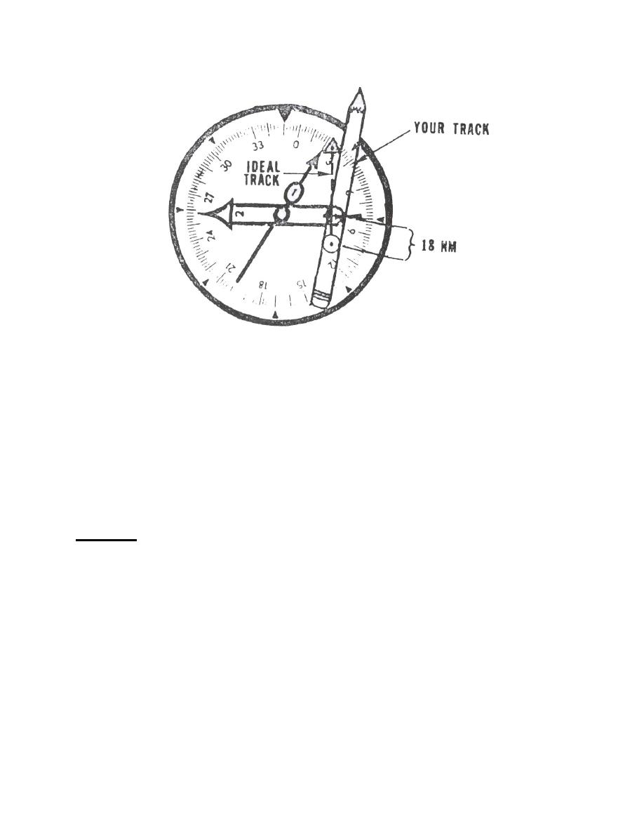
Figure 21
So, in both cases you have noted that you are actually flying a ground speed of 6 NM/min or
360 kts, thus indicating a headwind. The canting of your pencil indicates a crosswind;
therefore, confirming the actual wind from the northwest.
To complete a good point-to-point, you must now apply your knowledge of the wind and turn
from your current position (078R/38) to a new course and the desired point of 025R/60,
remembering to crab to hold yourself on that new course. You can then determine your
estimated time of arrival by recalling that you have done 6 nm/min, and applying that knowledge
to the distance you measure from the 078 R/38 to the 025R/60. The distance is about 48 NM,
so you would arrive in 8 minutes.
SUMMMY
You have learned three methods of point-to-point navigation. The pencil/eyeball method is
the method to utilize in the air. Although initially not as accurate as the CR-2 method, it saves
time and will become accurate as your proficiency develops. Your eventual goal is to involve
logic as much as possible to solve your point-to-point problems. Until that time, the
pencil/eyeball method and, to a lesser extent, the CR-2 will be utilized to help your
In addition to the TACAN and VOR, the T-34 can utilize its Area Navigation System
(RNAV) and accurately solve for point-to-points through its remote navigation computer.
Waypoint (point-to-point) bearing, distance and angular crosstrack deviation are continuously
supplied by the RNAV computer. Utilization of this system will be further examined in your
Flight Preparation Classes.
5-18 TACAN POINT-TO-POINT
|
|
Privacy Statement - Press Release - Copyright Information. - Contact Us |