 |
|||
|
|
|||
|
|
|||
| ||||||||||
|
|  INSTRUMENT NAVIGATION
Figure 19
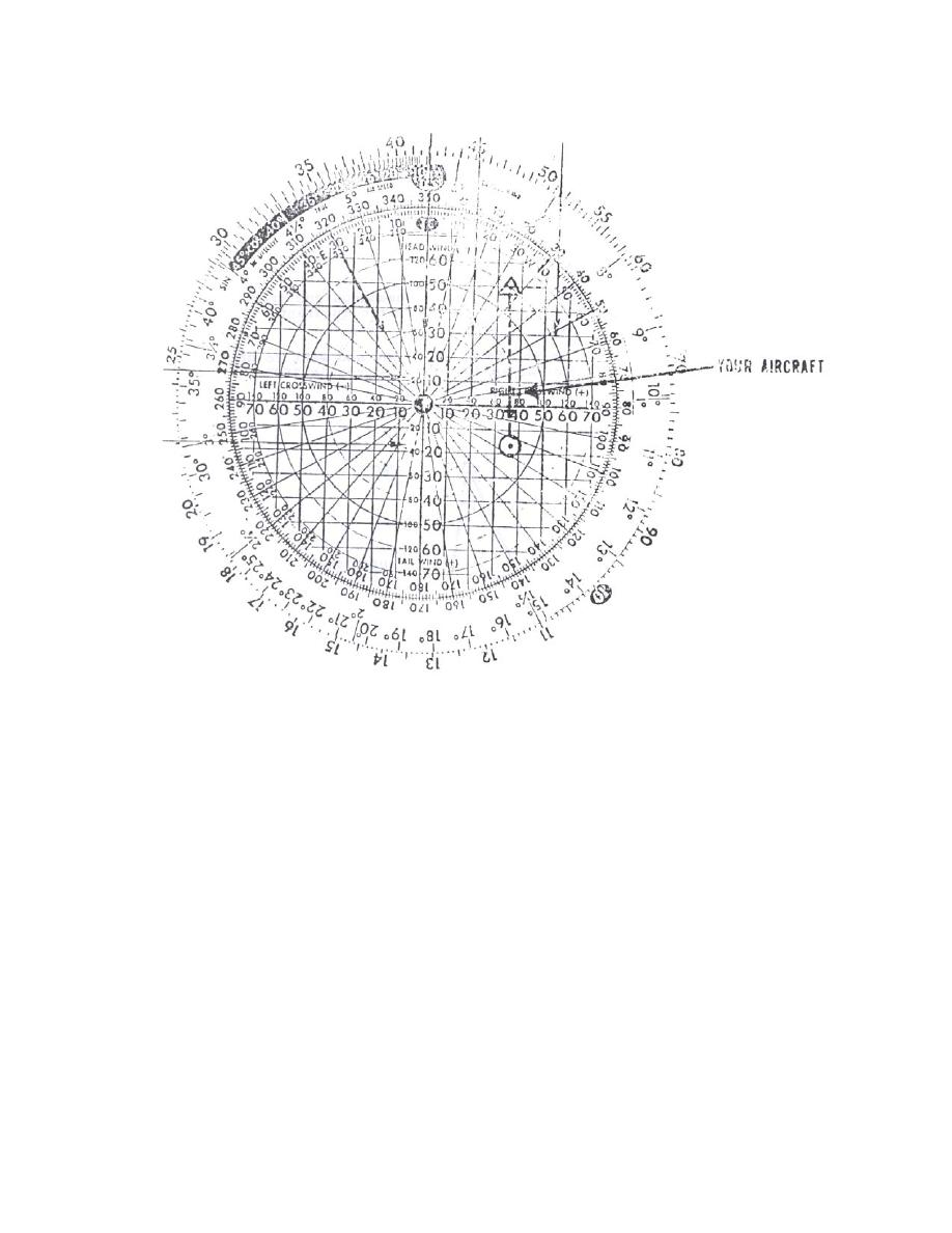
Note the solid arrows (Figure 19) which portray a headwind and a left crosswind. The sum
of those arrows is represented by the dotted arrow in the Northwest quadrant.
In a no-wind situation, your track should be directly along the line that connects the two
points, a course of 350. If you were to take up a heading of 350, however, and you still had that
northwesterly wind, you would soon find yourself off course, and behind schedule.
In order to maintain a track of 350', you must crab into the wind; and in order to determine
your time of arrival at the desired point, you must be aware of your ground speed.
Ground speed calculations during point-to-point navigation are more difficult than in radial
tracking because we can not directly utilize our changing DME. In order to compute a ground
speed, we must somehow measure our actual forward movement relative to a constant source.
For our purposes, we will use the CR-2 and the pencil.
To get a ground speed from the CR-2, simply note the distance you move from one TACAN fix
to another over a set period of time (Figure 20).
5-16 TACAN POINT-TO-POINT
|
|
Privacy Statement - Press Release - Copyright Information. - Contact Us |
