 |
|||
|
|
|||
|
|
|||
| ||||||||||
|
|  CHAPTER FOUR
AVIATION WEATHER
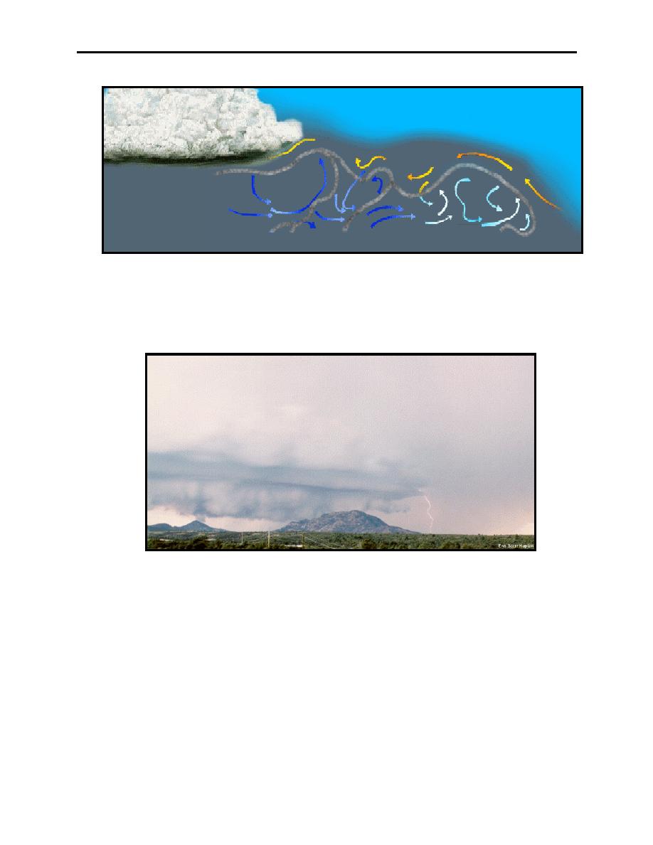
Figure 4-2 Gust Front
A roll cloud on the lower leading edge of a cumulonimbus cloud marks an area of strong eddy
currents and identifies the location of wind shear and severe turbulence occurring with the onset
of the gust front (Figure 4-3).
Figure 4-3 Roll Cloud
Large pressure changes can accompany thunderstorm formation due to the turbulence of updrafts
and downdrafts. Therefore, if the altimeter setting is not updated, the indicated altitude might be
in error by over 200 feet. The pressure variations associated with thunderstorms follow a
common pattern:
1.
A rapid fall in pressure as the storm approaches,
2.
An abrupt rise in pressure with the onset of the first gust and arrival of rain showers, and
3.
A gradual return to normal pressure as the storm passes and the rain ceases
4-4
Thunderstorms
|
|
Privacy Statement - Press Release - Copyright Information. - Contact Us |
