 |
|||
|
|
|||
|
|
|||
| ||||||||||
|
|  AVIATION WEATHER
CHAPTER THREE
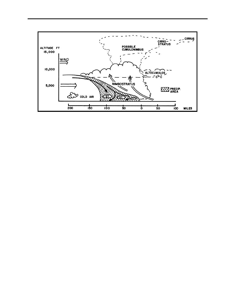
Figure 3-12 Cold Front Cloud Formation
Recognizing Cold Fronts During Flight
During a flight over flat terrain, you may see a long line of cumuliform clouds on the horizon.
These clouds may indicate you are flying toward an approaching active cold front. When flying
above an altocumulus layer extending ahead of the front, the lower frontal clouds are often
hidden. Stratus or stratocumulus decks extending many miles ahead of a front may conceal the
main clouds from a low flying aircraft.
Cold Front Flight Problems
Wind shifts: expect an abrupt wind shift when passing through a frontal zone, especially when
flying at lower altitudes. Turbulence is often associated with the wind shift. The wind generally
shifts from SW to NW with greater speeds behind the front.
Ceiling and visibility: if an active cold front moves at a moderate or rapid speed (15-30 knots),
its weather zone is generally less than 50 miles wide. If the front moves slower, its weather zone
may be broad enough to seriously affect flight operations for many hours. Ceilings and
visibilities are generally visual meteorological conditions (VMC), but isolated instrument
meteorological conditions (IMC) exist in heavy precipitation and near thunderstorms. Wider
areas of IMC conditions can exist in winter due to snow showers.
Turbulence: many active cold fronts have turbulent cloud systems associated with them, but
thunderstorms may not always be present. Even when there are no clouds, turbulence may still
be a problem. As a rule, expect a rough flight in the vicinity of an active cold front, even when
flying at a considerable altitude.
Mechanics of Frontal Systems 3-13
|
|
Privacy Statement - Press Release - Copyright Information. - Contact Us |