T-45C TS CR-02; ADV & IUT CR-01
Course Rules
T.
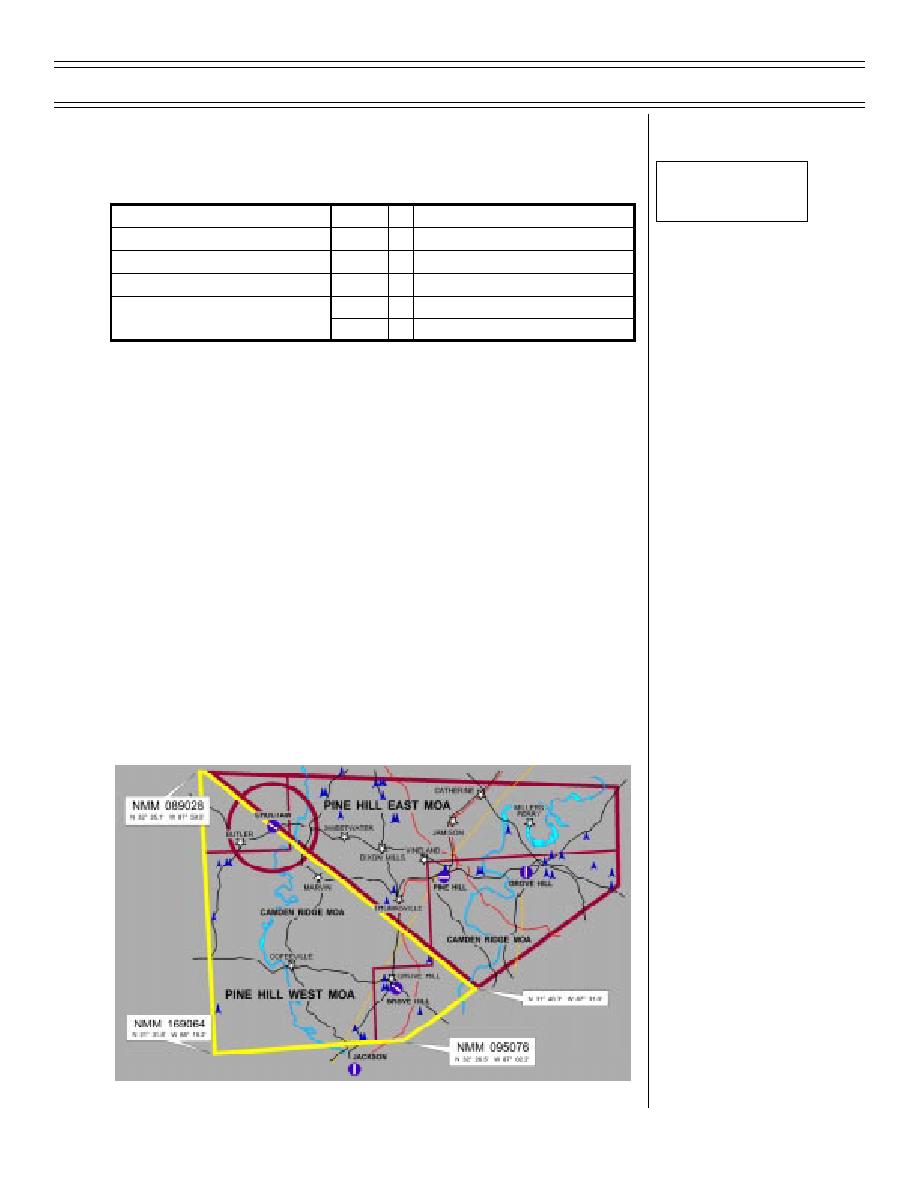
Pine Hill West MOA
Sg 3, fr 19G
Fig 21: Pine Hill West
AREA PINE HILL WEST
USERS
D/N
ALTITUDES
AREA FREQ
280.1/339.1
D/N
ENTRY/RECOVERY -- AS ASSIGNED BY ATC
ALL
D
10,000 -- FL230
TF
10,000 -- FL230
BLOCK ALT
DAY
D
10,000 -- FL230
ACM
10,000 -- FL230
NIGHT
D/N
10,000 -- FL230
FORM
STD ROUTING
SID/LID TO AREA
or Chk In-Flt Guide
1.
Northern boundary: east/west boundary limits:
NMM 151021
to
Lat/long below
[N 32 16.2', W 088 20.3'
to
N 31 40.3', W 087 31.0']
2.
Eastern boundary: north/south boundary limits:
Lat/long below
to
NMM 146074
[N 31 40.3', W 087 31.0'
to
N 31 33.5', W 087 43.2']
3.
Southern boundary: east/west boundary limits:
NMM 146074
to
NMM 169064
[N 31 33.5', W 087 43.2'
to
N 31 31.8', W 088 19.2']
4.
Western boundary: north/south boundary limits:
NMM 169064
to
NMM 151021
[N 31 31.8', W 088 19.22'
to
N 32 16.2', W 088 20.3']
Figure 21: PINE HILL WEST
Original (05-98)
Page 1-35


 Previous Page
