Instrument Flight
Flight Procedures
30 DME
R-090
D.
G. WCH 020
D. Course 025
2
N
33
3
WCH
H.
020
F.
D.
Wind
H.
21
E.
15
S
2
C.
C.
H.
60 DME
A.
A.
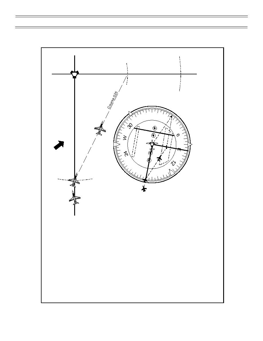
Tune and identify the station
A.
Visualize HSI compass card as compass rose with
B.
station at center
R-180
C.
Picture fix having greater distance from station
on its radial on outside edge of compass card
D.
Visualize second fix with lesser distance (determined by
the previous step) at proportional distance from center
of HSI on its radial
E.
Connect two fixes with an imaginary line or with
the aid of a straight edge
F.
Move line to center of HSI, paralleling original line
and read course to the fix off the outside edge of the compass card
G.
Turn to new course (plus wind correction if known); top of
imaginary line where it crosses compass card
H.
Update course and make corrections to PT-to-PT fix
periodically enroute
Figure 25: POINT-TO-POINT NAVIGATION
Page 79
(12-00) Original


 Previous Page
