Operational Navigation
Flying The Route
FLYING TO LANDMARKS
Funneling
Funneling is simply following some linear landmark (valley, river) until it intercepts the planned
landmark along or on your route of flight, or purposely selecting a heading which will lead to a
positive landmark. If you intercept such a linear landmark and know where it leads, use it to guide
you to your next checkpoint.
Roads
It is quite possible that your route will parallel a road or railroad for a leg or considerable portion of a
leg. In this case, it is important to keep the road in sight while maintaining your correct position and
distance from it. For instance if your course line stays to the left side of the road and never crosses
it, then you should always remain left of the road and never cross it.
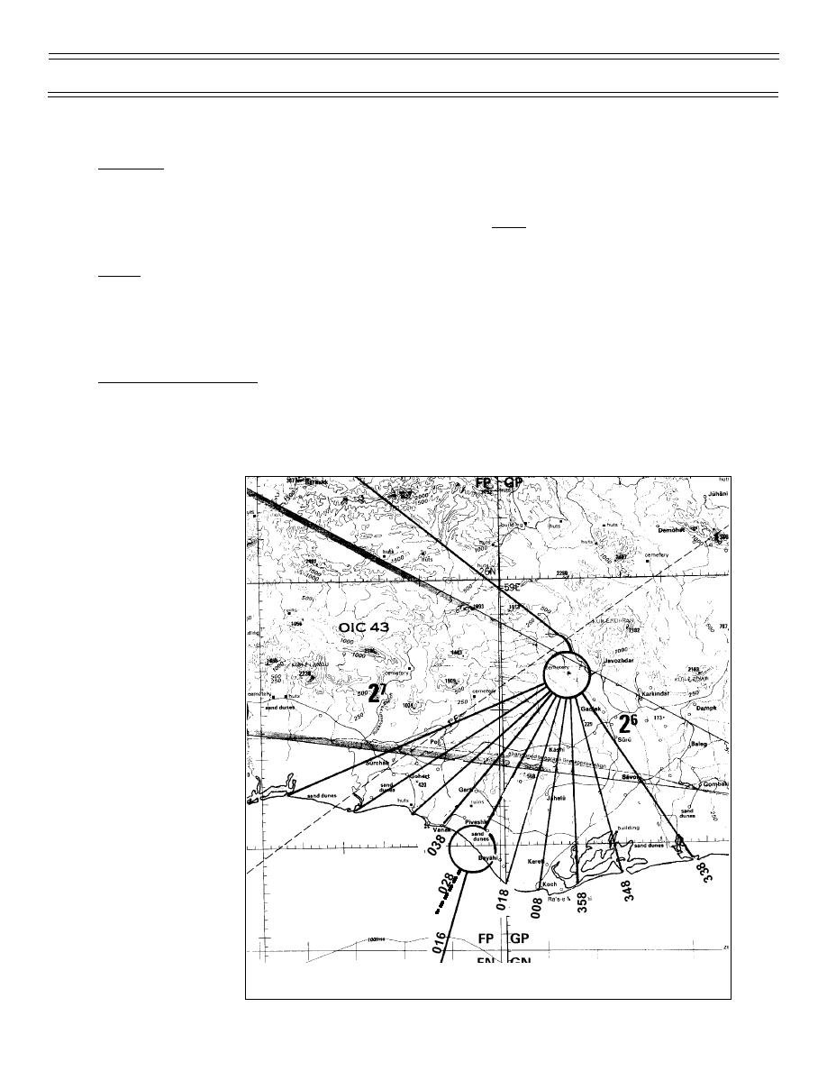
Coast-in (Spoke Method)
The spoke method (Figure 4) is used to get onto the proper course after flying for a considerable
distance over water; (as a Naval aviator, you will fly over water a great deal). This involves drawing
several spokes to either side of your planned track to the first inland checkpoint or to a good
intermediate checkpoint 10-20 miles inland from the coast-in point. As a rule of thumb, draw lines
every 10 degrees of
heading on each side
of your coast-in
checkpoint. Draw
them to the sides for
a distance of 10% of
distance flown over
water or between the
planned coast-in
point and positive
landmarks on each
side. This is called
the "spoke method"
because the course
lines converge on the
first inland check-
point. You should
choose checkpoints
on the coast to draw
the spokes from if
you have good,
positive features.
068
Otherwise you will
8
8
05
04
have to search for a
prominent feature
further inland and
then adjust your
course in accordance
with the nearest
spoke.
Measure heading for
each spoke as you
Figure 4: SPOKE METHOD OF COAST-IN
(4-03) Original
Page 14


 Previous Page
