 |
|||
|
|
|||
|
Page Title:
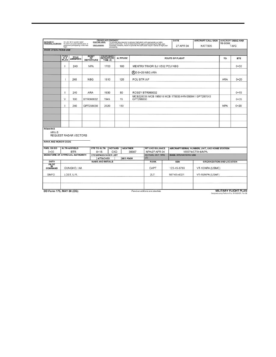
Figure 4-12 Military Flight Plan, DD 175 |
|
||
| ||||||||||
|
|  CHAPTER FOUR
T-6A NAVIGATION
Figure 4-12 Military Flight Plan, DD 175
413.
OTHER MISSION PLANNING CONSIDERATIONS
After computing the jet card with best known winds, preparing the DD 175, and making the final
chart annotations, there are still a few items left to complete before stepping out to the aircraft.
NOTAMs must be checked prior to each flight. Be sure to check the hourly, regional (by state),
and special notices. Low-level route closures, military exercises, NAVAID status, and divert
field closure can all have an effect on your mission.
Weather not only includes the winds used to compute your flight plan, but also the conditions
permitting low-level flight, such as visibility. For T-6A Navigation flights, the required visibility
minimums are the same as those required for standard VFR flight, 500 feet below, 1000 feet
above, 2000 feet horizontal clear of clouds, and three miles visibility.
4-14
FUEL PLANNING, JET LOGS, DD 175
|
|
Privacy Statement - Press Release - Copyright Information. - Contact Us |
