 |
|||
|
|
|||
|
|
|||
| ||||||||||
|
|  CHAPTER TWO
T-6A NAVIGATION
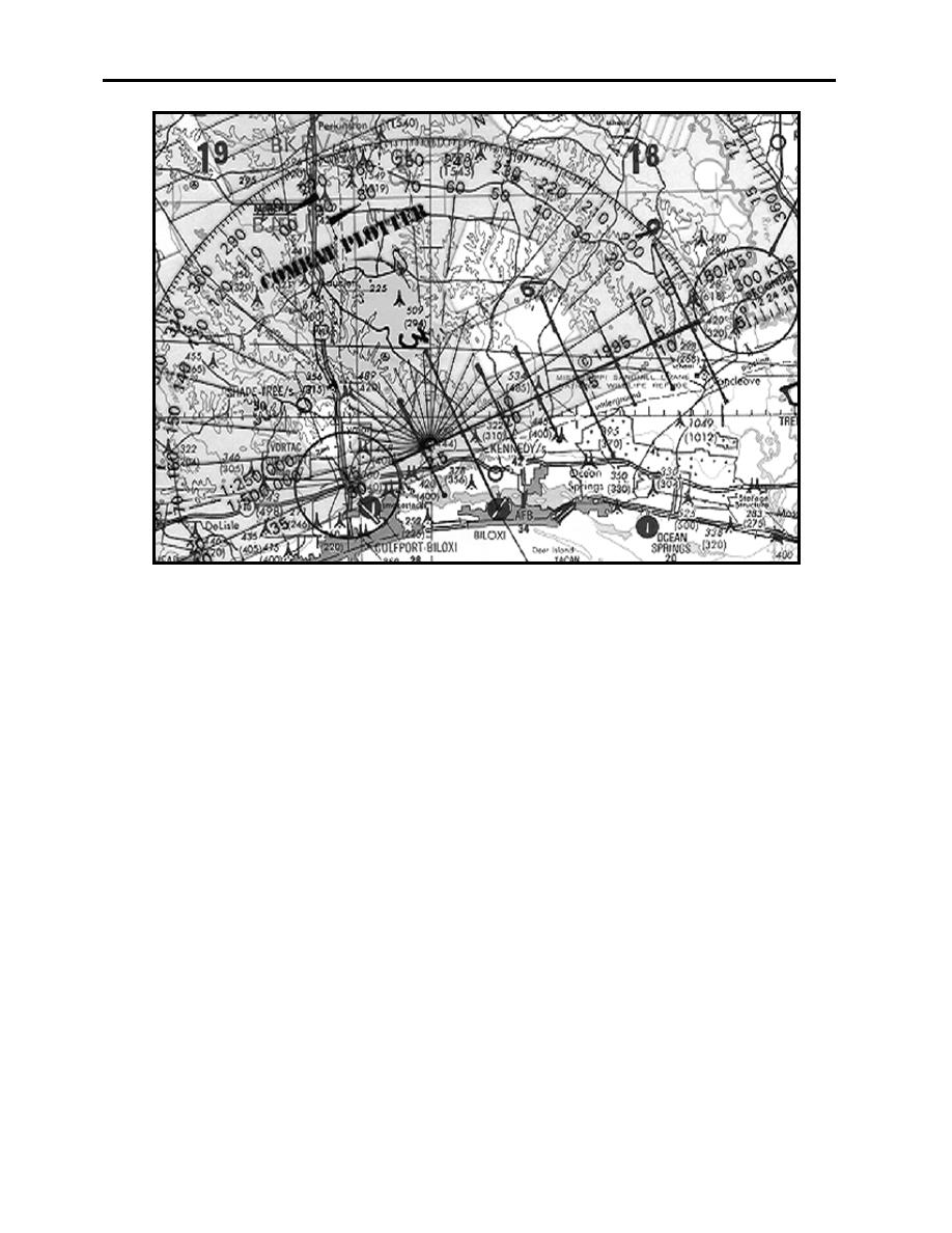
Figure 2-3 Course Distance
Measuring distances is a straightforward process. Using a straight edge or the combat plotter,
measure the distance between the two points and then use a longitude line as a scale to determine
the distance. Because the TPC is a Lambert Conformal Projection, each minute of latitude is equal
to one nautical mile, and the scale about a point in any direction is approximately the same.
Therefore, the distance between each tick along a longitude line is equal to one nautical mile. In
Figure 2-3, the course distance is 26 NM. All distances should be measured to the nearest 1/2 NM.
2-4
LOW-LEVEL CHART PREPARATION
|
|
Privacy Statement - Press Release - Copyright Information. - Contact Us |
