 |
|||
|
|
|||
|
Page Title:
Figure 1-12 Coastal Hydrography |
|
||
| ||||||||||
|
|  T-6A NAVIGATION
CHAPTER ONE
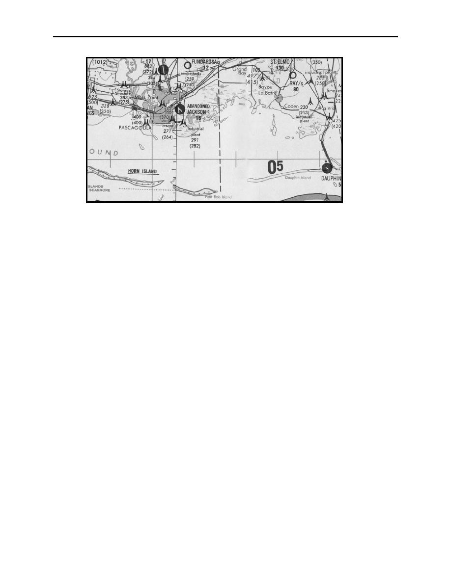
Figure 1-12 Coastal Hydrography
Coastlines may be used in obtaining time checks inbound or outbound from the land mass and
may be used for position determination if significant points or inlets are available (Figure 1-12).
Coastal hydrography includes oceans, coastlines, lakes, rivers, canals, swamps, reefs, and
numerous other hydrographic features. Open water may be portrayed by tinting, shading, or may
be left blank. Vegetation is not shown on most small-scale charts. Forests and wooded areas in
certain parts of the world are portrayed on some medium-scale charts. On some large-scale
charts, park areas, orchards, hedgerows, and vineyards are shown. Portrayal may be by solid tint,
or supplemented shading.
Aeronautical information symbols on charts include airfields, radio aids to navigation,
commercial broadcasting stations, Air Defense Identification Zones (ADIZ), compulsory
corridors, restricted airspace, warning notes, lines of magnetic variation, and special navigation
grids. Some aeronautical information is subject to frequent change. For economy of production,
charts are retained in stock for various periods of time. Thus, only the more "stable" type
information is printed on navigation charts. Aeronautical type data subject to frequent change is
provided by the DOD Flight Information Publications (FLIP) documents. Consult the DOD
Flight Information Publications, Chart Updating Manual (CHUM), and Notices to Airmen
(NOTAMS), for the most current air information or chart information.
Aerodromes are depicted on ONC and TPC charts with symbols as illustrated in Figures 1-13
through 1-16:
A major aerodrome has at least 3000 feet of hard surface runway.
A solid dark blue circle depicts major aerodromes on a TPC chart. The diameter of the circle
represents 8000 feet. A runway pattern may be depicted and if so it will be to scale.
CHART LEGEND REVIEW
1-19
|
|
Privacy Statement - Press Release - Copyright Information. - Contact Us |
