 |
|||
|
|
|||
|
|
|||
| ||||||||||
|
|  T-6A NAVIGATION
CHAPTER ONE
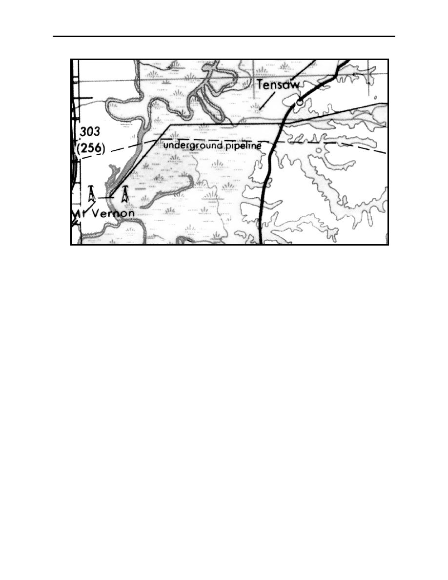
Figure 1-10 Pipelines
Pipelines are depicted on the chart by a broken line with the words "Underground Pipeline."
Actual buried pipeline will not be visible from the air (no matter how low you fly). As with
power transmission lines, the cut out area where trees were removed during installation is visible.
May appear as dirt roads in the air, but typically appear abnormally straight, where a dirt road has
turns.
Populated areas are visibly prominent and easily identified (Figure 1-11). Distinguished cities
are valuable checkpoints. The city outline shown on the chart often does not include recent
suburban developments. Although the shape of the built-up area of the city is shown on the
chart, do not attempt to identify a city on this basis alone. The city outline shown on the chart
often does not include recent suburban developments. The portrayed built-up area is intended
primarily to identify the location where the significant vertical development of the city exists.
Generally, only two categories of populated areas are shown on the TPC:
1.
Those of relatively large size (usually at least one mile square) and known shape, which are
portrayed with city outlines.
2.
Isolated communities of small size or unknown shape, which are shown by means of a
small circle.
CHART LEGEND REVIEW
1-17
|
|
Privacy Statement - Press Release - Copyright Information. - Contact Us |
