 |
|||
|
|
|||
|
|
|||
| ||||||||||
|
|  FLIGHT TRAINING PUBLICATION (FLIP) STUDENT GUIDE
CHAPTER SIX
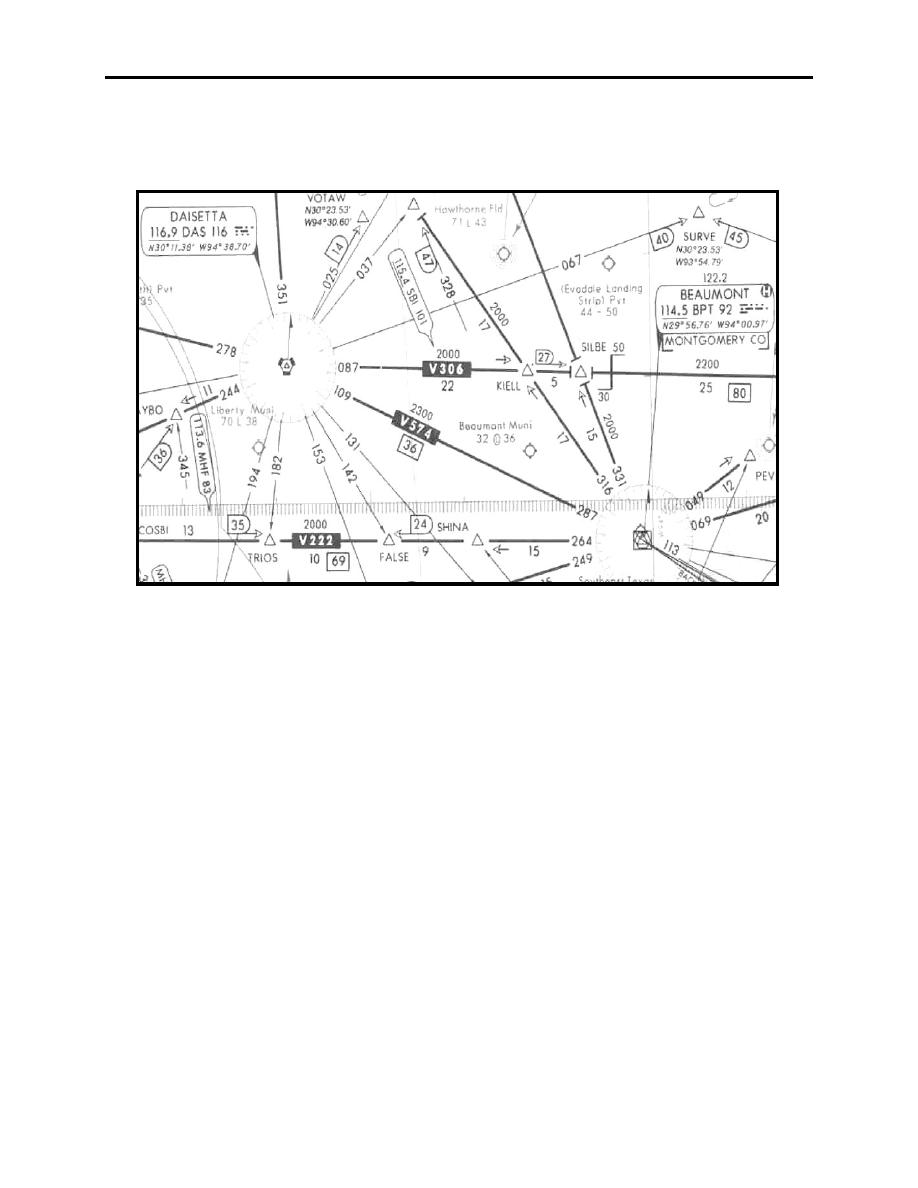
In most situations, there will be no course change, or published COP. In this case, switch your
navigational equipment to the next station when you are midway between the stations, for
example, at 18 DME from Daisetta or Beaumont V574 (Figure 6-19).
Figure 6-19 V574
Area Charts
Area Charts are published every eight weeks and are used in conjunction with the Enroute Low
Altitude Charts. They are enlargements of selected terminal areas and can be very beneficial to
an aircrew in flight. Proper understanding and use of Area Charts will greatly facilitate air
navigation at these major traffic hubs throughout the U.S. The cities for which an Area Chart is
published are shown on the map of the U.S. on the rear panel of the Low Altitude Chart. On the
chart itself, Area Chart Coverage is indicated by a heavy dashed blue outline. An example of the
Atlanta area on the Low Chart is shown on Figure 6-20.
ENROUTE LOW ALTITUDE AND AREA CHARTS
6-13
|
|
Privacy Statement - Press Release - Copyright Information. - Contact Us |
