 |
|||
|
|
|||
|
|
|||
| ||||||||||
|
|  INSTRUMENT NAVIGATION
ENROUTE CHARTS
Every flight you will fly at VT-10 will in some way involve the use of a navaid. It may be a
local hop during which you take off and stay within 50 nm of Pensacola, or it may be a cross
country flight to the West Coast. In both cases you will come to depend on navaids for
establishing your position and therefore a means of returning to base or other destination.
The routes between navaids are called AIRWAYS. In the low altitude structure (up to but
not including 18,000' MSL) they are called Victor airways. From 18,000' MSL to FL 450, they
are called Jet Routes.
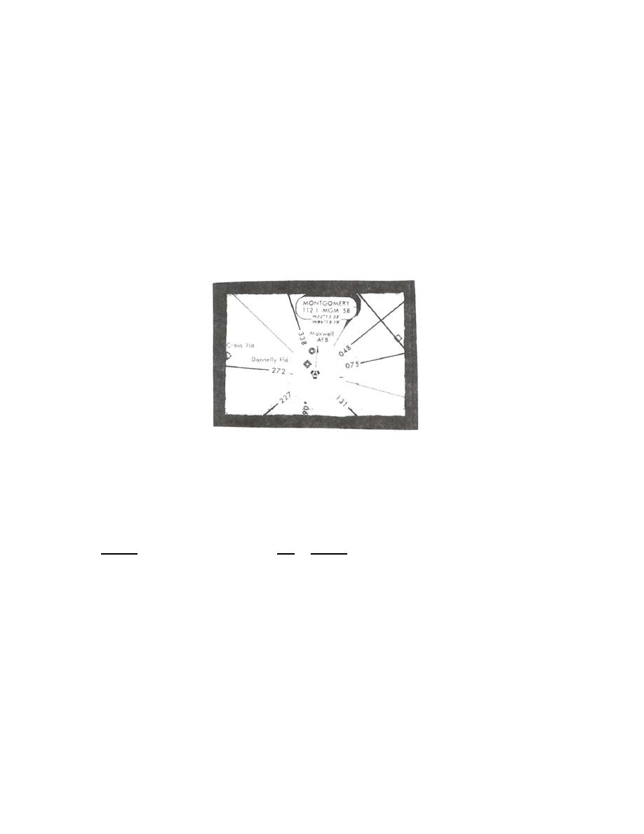
Note that a compass rose on an enroute chart is oriented to Magnetic North; therefore, all
radials emanating from the navaid are magnetic radials (See Figure 9).
Figure 9
Navigation from one VOR, TACAN or VORTAC station to another by means of radials is
referred to as radial tracking navigation.
A course is a magnetic track to be flown over the ground either to or from the radio
navigational facility (TACAN, VOR or VORTAC stations). As we have seen, a radial extends
only FROM a station, a course is either TO or FROM a station.
Note in the following figure (Figure 10) that the jet routes connecting the different navaids
have radial values assigned to them. Extending from the top portion of the New Orleans
compass rose is the 351 radial. If we flew outbound from MSY toward MCB, our course and
radial would both be 351.
RADIAL TRACKING AND COURSE CONTROL 3-7
|
|
Privacy Statement - Press Release - Copyright Information. - Contact Us |
