 |
|||
|
|
|||
|
|
|||
| ||||||||||
|
|  INSTRUMENT NAVIGATION
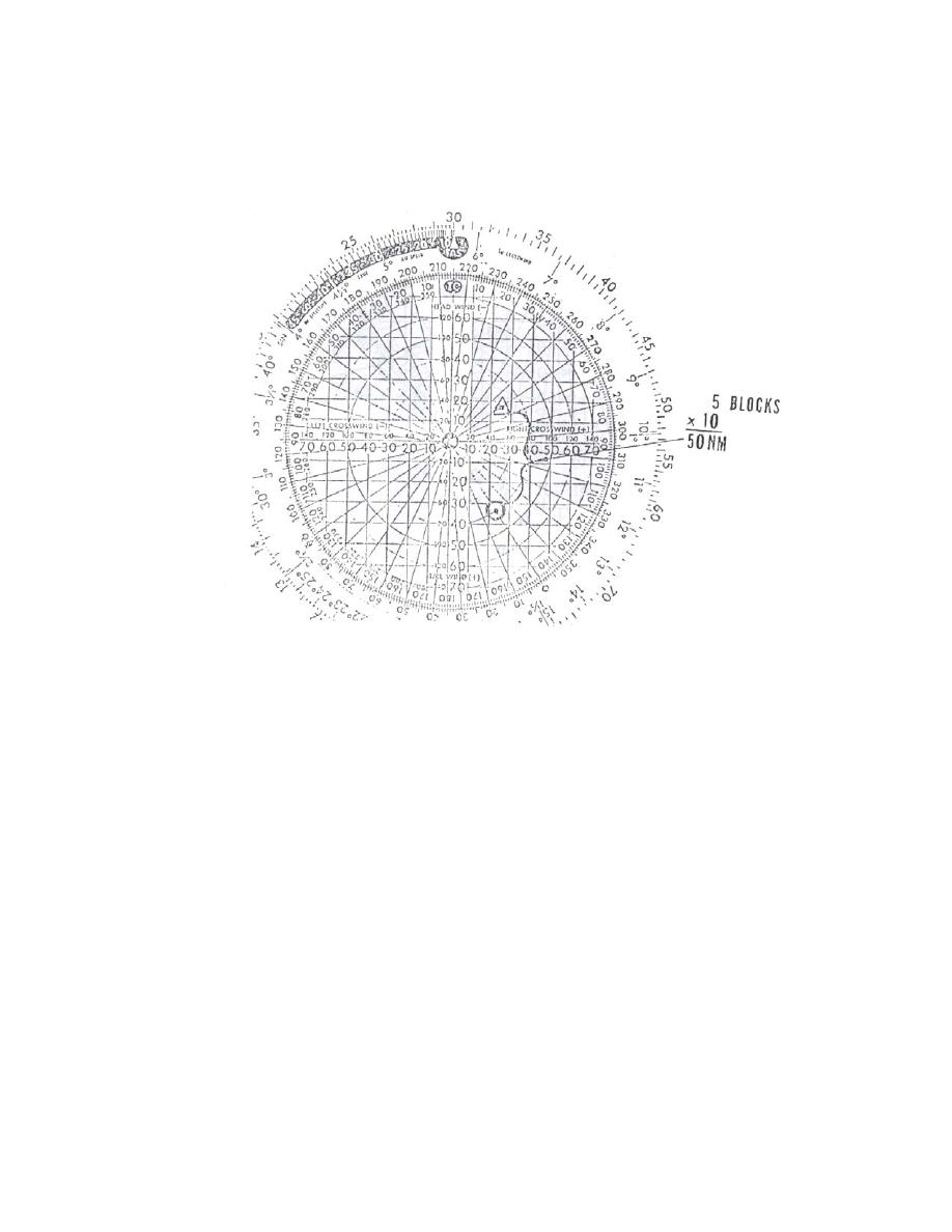
Now, to determine the distance between the two points in the example, just count the number
of squares (including fractions) and multiply by 10 since each square is 10 NM in this case. See
Figure 5. The scale of NM per block may be increased as necessary. For example, for a distance
of 150 NM, each square may represent 20 NM. (Figure 5)
Figure 5
Pencil/Eyeball Method
Utilizing the same principles we learned on the CR-2, we can work point-to-point navigation
by the pencil/eyeball method. The big drawback to the CR-2 method is that it consumes too
much time. The pencil method, though not as accurate, is much quicker and shall be used on
your training flights here in VT-10.
In working this method, we equate the center of the RMI to the TACAN station. The
compass card then becomes the surrounding airspace. The tail of your #2 needle corresponds to
your radial, and your aircraft position will be somewhere along its length (between the center and
the end of the tail) (Figure 6)
5-6 TACAN POINT-TO-POINT
|
|
Privacy Statement - Press Release - Copyright Information. - Contact Us |
