 |
|||
|
|
|||
|
Page Title:
Global Positioning System (GPS) |
|
||
| ||||||||||
|
|  INSTRUMENT FLIGHT RULES WORKBOOK
CHAPTER ONE
109.
GLOBAL POSITIONING SYSTEM (GPS)
Global Positioning System (GPS) navigation has become an integral part of IFR enroute,
terminal, and approach operations. The GPS receiver used in the T-34C is the KLN900.
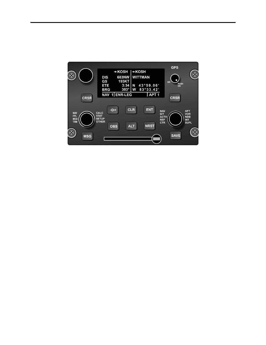
Figure 1-18 KLN-900 Control Panel
GPS is a United States satellite-based radio navigational, positioning, and time transfer system
operated by the Department of Defense (DOD). The system provides highly accurate position
and velocity information and precise time on a continuous global basis to an unlimited number of
properly equipped users. The system is unaffected by weather and provides a worldwide
common grid reference system based on the earth-fixed coordinate system. For its earth model,
GPS uses the World Geodetic System of 1984 (WGS-84) datum.
GPS provides horizontal positioning accuracy of 22 meters and a vertical accuracy of 27.7
meters (depending on the model and mode of GPS used).
GPS operation is based on the concept of ranging and triangulation from a group of satellites in
space, which act as precise reference points. A GPS receiver measures distance from a satellite
using the travel time of a radio signal. Each satellite transmits a specific code, called a
course/acquisition (CA) code, which contains information on the satellite's position, the GPS
system time, and the health and accuracy of the transmitted data. Knowing the speed at which
the signal traveled (approximately 186,000 miles per second) and the exact broadcast time, the
distance traveled by the signal can be computed from the arrival time.
The GPS receiver matches each satellite's CA code with an identical copy of the code contained
in the receiver's database. By shifting its copy of the satellite's code in a matching process, and
by comparing this shift with its internal clock, the receiver can calculate how long it took the
signal to travel from the satellite to the receiver. The distance derived from this method of
computing distance is called a pseudo-range because it is not a direct measurement of distance,
but a measurement based on time. Pseudo-range is subject to several error sources such as
ionospheric and tropospheric delays and multipath errors.
INTRODUCTION TO AIRBORNE NAVIGATION AND COMMUNICATIONS
EQUIPMENT AND PRINCIPLES OF OPERATION 1-23
|
|
Privacy Statement - Press Release - Copyright Information. - Contact Us |
