 |
|||
|
|
|||
|
Page Title:
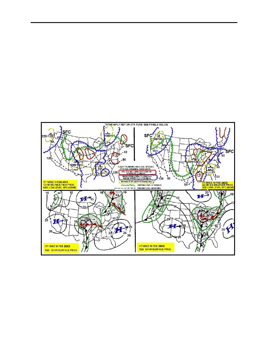
Figure 2-24. Low Level Significant Weather Prognostic Chart for Questions 10-13 |
|
||
| ||||||||||
|
|  CHAPTER TWO
METEOROLOGY FLIGHT PLANNING
8. The line symbol in southern Canada extending west-northwest to east-southeast is called a
__________, and the line symbol from Minnesota south-southeast to western Tennessee is called
a __________.
a.
warm front; cold front
c.
trough; ridge
b.
occlusion; front
d.
ridge; trough
9. Which one of the following weather products could be used to determine areas of forecast
IFR weather?
a.
Surface Analysis Chart
c.
Visible Satellite Imagery
b.
Low Level Significant Weather
d.
Winds-Aloft Forecasts
Prognostic Chart
Figure 2-24 Low Level Significant Weather Prognostic Chart for Questions 10-13
10. Which panel of the Low Level Significant Weather Prognostic Chart shows the 24-hour
significant weather forecast?
a.
Upper left
c.
Lower left
b.
Upper right
d.
Lower right
2-28 DATA DISPLAYED ON WEATHER IMAGERY PRODUCTS
|
|
Privacy Statement - Press Release - Copyright Information. - Contact Us |
