 |
|||
|
|
|||
|
|
|||
| ||||||||||
|
|  CHAPTER THREE
AVIATION WEATHER
Precipitation and icing conditions: active cold fronts usually have a relatively narrow belt of
precipitation, especially if the precipitation is showery. Icing may be severe in cumuliform
clouds. Slow-moving cold fronts may have a broader area of precipitation and greater threat of
remaining in icing conditions for a longer period.
Thunderstorms and squall lines: severe weather is implied to exist in areas of reported
thunderstorms. Chapter Four will detail the hazards associated with thunderstorms.
Squall Lines
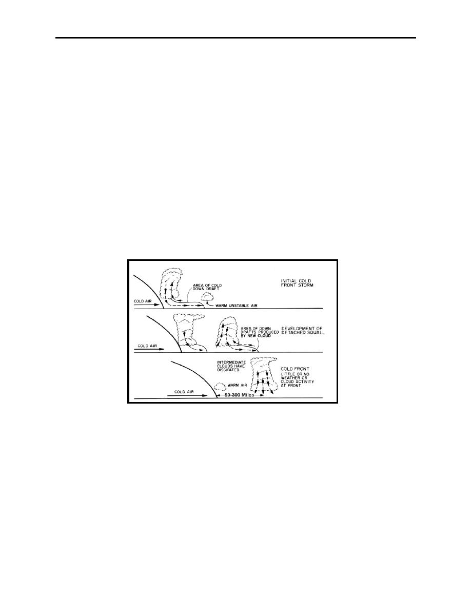
A squall line is a line of violent thunderstorms. They are indicated on surface charts by a dashed,
double-dotted purple line. They develop 50 to 300 miles ahead of the cold front and roughly
parallel to it. They form when cold air downdrafts flowing ahead of a cold front lift additional
warm, unstable air. The uplifted air develops its own updrafts and downdrafts and starts the
thunderstorm development cycle (Figure 3-13). Sometimes, however, squall lines can be located
nowhere near a cold front, possibly from the convergence of air flows at one location. Squall
lines are usually the most intense during the late afternoon and early evening hours, just after
maximum daytime heating.
Figure 3-13 Squall Line Formation
It is often impossible to fly through squall lines, even with radar, since the storms are extremely
close to one another. Similar to cold fronts, squall lines will also have a 90 wind shift from the
SW to the NW.
309.
WARM FRONTS
A warm front is the boundary of the advancing warm air mass overtaking and replacing a colder
air mass. To do so, the warmer, less dense air must ride up and over the top of the cold air mass.
Figure 3-14 shows the manner in which a warm front is depicted on a surface weather chart. The
warm air mass gradually moves up over the frontal surface creating a broad area of cloudiness.
3-14 Mechanics of Frontal Systems
|
|
Privacy Statement - Press Release - Copyright Information. - Contact Us |
