 |
|||
|
|
|||
|
|
|||
| ||||||||||
|
|  AVIATION WEATHER
CHAPTER TWO
Sea and Land Breezes
The differences in the specific heat of land and water cause land surfaces to warm and cool more
rapidly than water surfaces through insolation and terrestrial radiation. Therefore, land is
normally warmer than the ocean during the day and colder at night. This difference in
temperature is more noticeable during the summer and when there is little horizontal transport of
air in the lower levels of the atmosphere. In coastal areas, this difference of temperature creates
a tendency for the warmer, less dense air to rise, and the cooler, denser air to sink, which
produces a pressure gradient. During the day, the pressure over the warm land becomes lower
than over the colder water. The cool air over the water moves toward the lower pressure,
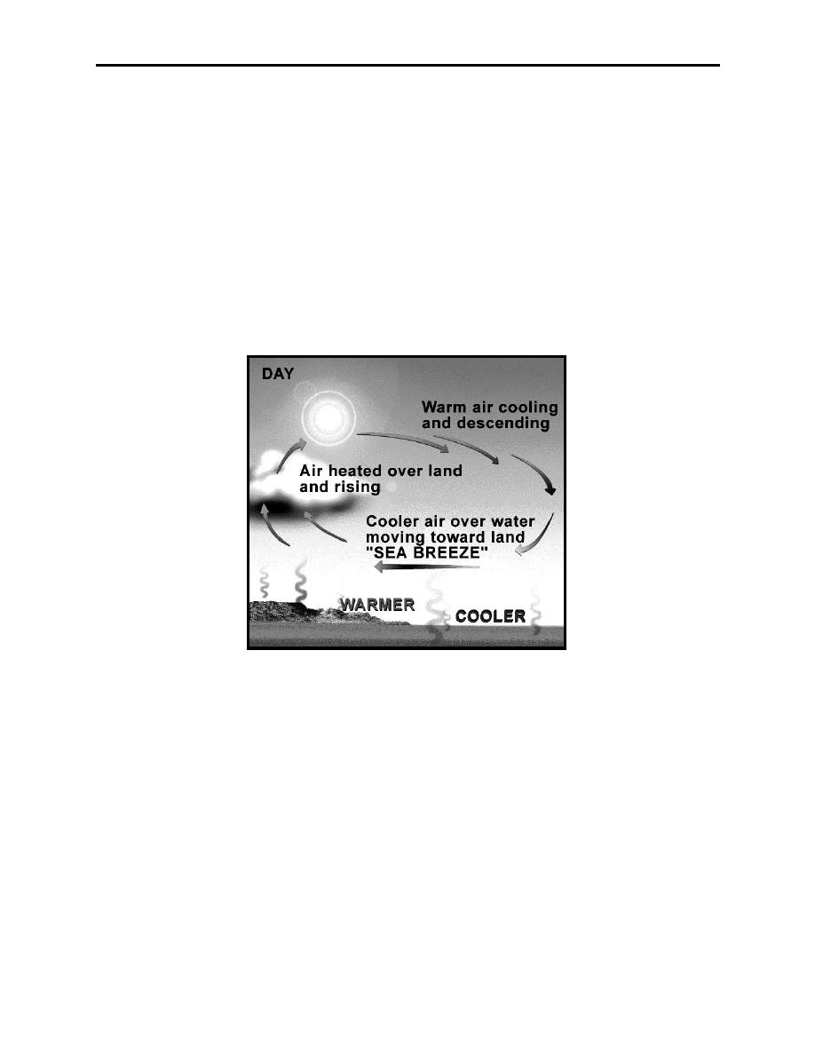
replacing the warm air over the land that moved upward. The resulting onshore wind, blowing
from the sea, is called a sea breeze, with speeds sometimes reaching 15 to 20 knots (Figure 2-
10).
Figure 2-10 Sea Breeze
At night, the circulation is reversed so that the air movement is from land to sea, producing an
offshore wind called the land breeze (Figure 2-10). The sea breezes are usually stronger than the
land breezes, but they seldom penetrate far inland. Land and sea breezes are shallow in depth,
and should be considered during takeoff and landing near large lakes and oceans.
Atmospheric Mechanics of Winds, Clouds and Moisture, and Atmospheric Stability
2-11
|
|
Privacy Statement - Press Release - Copyright Information. - Contact Us |