 |
|||
|
|
|||
|
|
|||
| ||||||||||
|
|  AVIATION WEATHER
CHAPTER THREE
Naturally, moist air masses will have a greater potential for producing clouds and precipitation
than dry air masses. Most importantly, though, its temperature indicates the stability of the air
mass. Warm air masses bring stable conditions, while cold air masses are inherently unstable.
This temperature classification is relative to the surface beneath it. An air mass with a
temperature of 90F over a surface with a temperature 100F is classified as cold.
A maritime air mass would be reclassified to continental when precipitation over land occurs. A
continental air mass would be reclassified to maritime if evaporation over water occurs
(Figure 3-2).
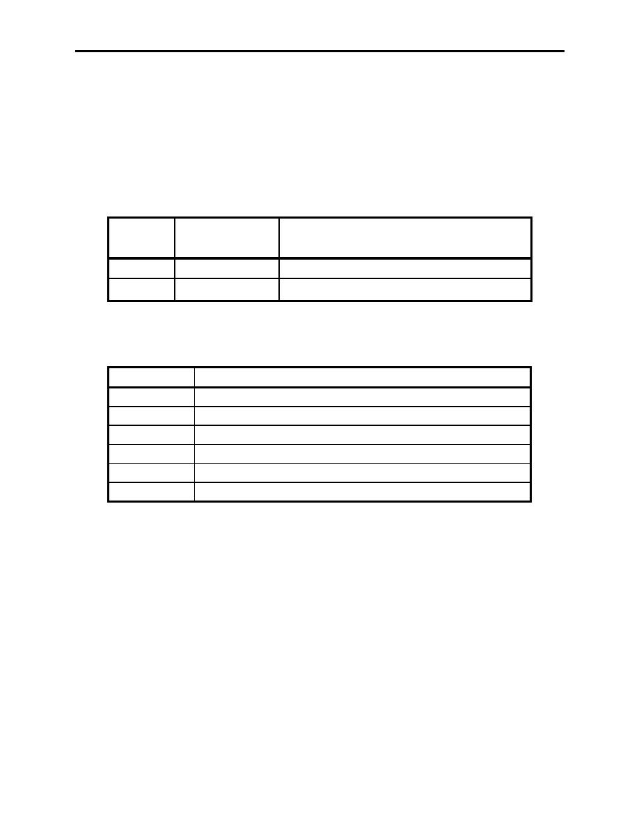
Moisture Content
Symbol
Surface
(Related to Dew point Temperature)
m
Maritime
High
c
Continental
Low
Figure 3-2 Source Region Surface
These symbols are combined to describe air masses as follows (Figure 3-3)
Symbol
Source Region and Surface
cA
Continental Arctic
cP
Continental Polar
mP
Maritime Polar
mT
Maritime Tropical
cT
Continental Tropical
E
Equatorial
Figure 3-3 Air Mass Symbology
Air masses are also classified by temperature. An air mass leaving its source region will
generally be warmer than the surface over which it is flowing if it is moving north, or colder than
the surface over which it is flowing if it is moving south. If the air mass is warmer than the
surface, it is cooled by contact with the cold ground, becomes more stable, and is called a warm
air mass (Figure 3-3). If the air mass is colder than the surface over which it is moving, it is
heated from below, resulting in convective currents and instability and is called a cold air mass.
305.
FRONTAL SYSTEMS
A front is an area of discontinuity that forms between two contrasting air masses when they are
adjacent to each other. A front can be thought of as a border, boundary, or line between the air
masses. These air masses must have sufficiently different temperature and moisture properties,
the defining characteristics of an air mass, otherwise there would be little reason to distinguish
between them. Since air masses cover many thousands of square miles, the boundary between
Mechanics of Frontal Systems 3-3
|
|
Privacy Statement - Press Release - Copyright Information. - Contact Us |
