 |
|||
|
|
|||
|
|
|||
| ||||||||||
|
|  AVIATION WEATHER
CHAPTER THREE
or no turbulence. Precipitation from cumuliform clouds is showery and the clouds indicate
turbulence.
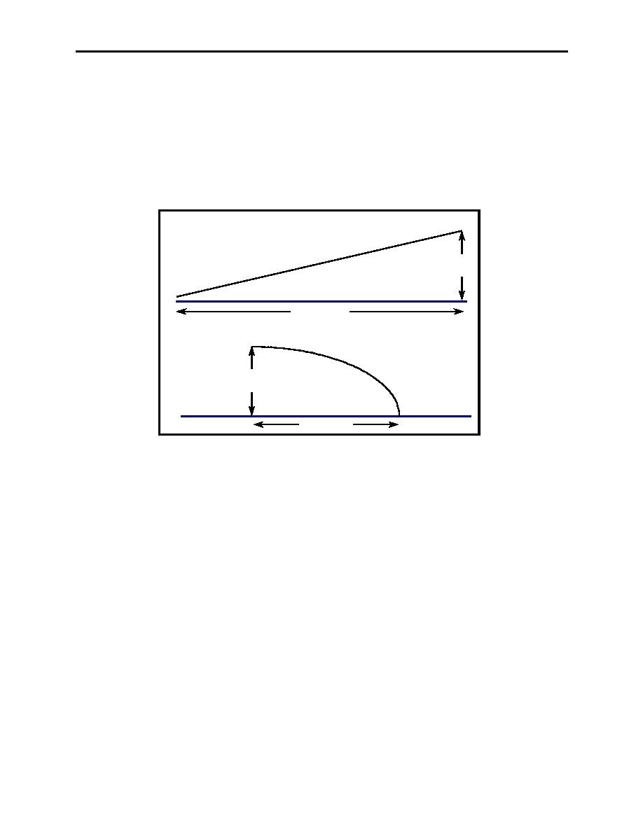
The slope is the ratio of the vertical rise to horizontal distance. The slope of a warm front is
generally shallow, while the slope of a cold front can be quite steep (Figure 3-10). Shallow
frontal slopes tend to produce extensive cloudiness with large areas of steady precipitation, while
steep frontal slopes tend to move rapidly producing narrow bands of cloudiness and showery
precipitation. Steep frontal slopes normally separate air masses of vastly different properties,
indicating the potential for more severe weather.
49 F
SLOPE 200 : 1
52 F
48 F
WARM
1
AIR MASS
51 F
MILE
54 F
COLD
57 F
AIR MASS
60 F
200 MILES
47 F
50 F
SLOPE 100 : 1
42 F
48 F
1
51 F
COLD
WARM
MILE
54 F
AIR MASS
AIR MASS
57 F
60 F
100 MILES
Figure 3-10 Frontal Slope
The speed of the frontal movement affects the weather associated with it. A narrow band of
more severe weather generally accompanies faster moving fronts. On the other hand, slower
moving fronts have less severe weather, but the frontal zone is more extensive.
The greater the contrast in temperature and moisture between the colliding air masses, the greater
the possibility of weather associated with a front, particularly severe weather. For example, most
tornadoes occur in the spring due to very cold, dry air from Canada colliding with very warm,
moist air from the Gulf of Mexico.
308.
COLD FRONTS
A cold front is the leading edge of an advancing cold air mass. In this case, the colder (more
dense) air mass is overtaking and wedging underneath a relatively warmer (less dense) air mass.
As the cold air pushes the warm air upward, this motion sometimes produces very violent and
unstable conditions, to include strong thunderstorms (cumulonimbus clouds) and severe
turbulence. Figure 3-11 shows the manner in which a cold front is depicted on a surface weather
chart. Cold fronts move toward the SE at 20 knots, on average, and the wind shift is from the
SW to the NW.
Mechanics of Frontal Systems 3-11
|
|
Privacy Statement - Press Release - Copyright Information. - Contact Us |
