 |
|||
|
|
|||
|
Page Title:
Figure 4.1-1 The Polar Perspective |
|
||
| ||||||||||
|
| 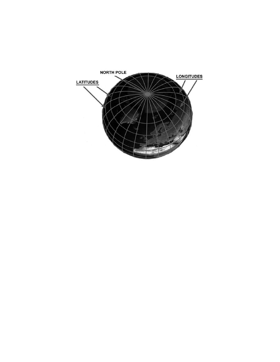 Every point on the surface of the earth can be defined by a specific latitude (angular
distance north or south of the equator) and by a specific longitude (angular distance east
or west of the Prime Meridian) (Figure 4.1-1). Lines of latitude are also called parallels,
while lines of longitude can be referred to as meridians.
Figure 4.1-1 The Polar Perspective
Since they are angular distances, latitude and longitude are measured in degrees and
minutes. There are 60 minutes in each degree. Latitude, starting at the equator, is
measured from 0 to 90 degrees and labeled North or South. Longitude, starting at the
prime meridian (0 Longitude), is measured from 0 to 180 degrees and labeled East or
West, and ends at the International Date Line (180 Longitude).
In Figure 4.1-2, NAS Pensacola is located at 30 degrees, 21 minutes north latitude; and
087 degrees, 19 minutes west longitude. This position would be written as: 30 22'N, 087
19'W. (Note: Always read latitude first and use 3 digits for longitude to avoid confusion)
4.6-10
|
|
Privacy Statement - Press Release - Copyright Information. - Contact Us |
