 |
|||
|
|
|||
|
|
|||
| ||||||||||
|
|  T-45C TS INav-01
Review of FLIP and FAA Publications
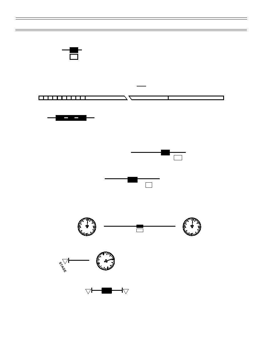
Distance boxes,
, shown on Jet Routes, depict distances between NAVAIDs and/or between
J35
129
reporting points. Distances between fixes on “Direct” legs, or distances along only a portion of a Jet Route
segment, can be measured by using a straight edge, marking off the distance, and applying the marked off
distance to the convenient 250-nm scale at either the top or bottom of your particular chart. The scale is
divided into 50-nm increments, with one increment subdivided into 5-nm increments. Some mileages are
provided between other than reporting points, which are NOT in boxes.
1" = 30 NM
50
0
NAUTICAL MILES
150
200
Many times, the paths of two or more jet routes will coincide on the chart with the J being printed only
once:
J4
42
66
You should file for the jet route which extends farthest along your planned profile of flight.
The High Altitude Charts depict the jet route system - 18,000 ft MSL through flight level 450, which is
contained within Class A airspace; therefore, all MINIMUM EN ROUTE ALTITUDES (MEAs) are 18,000 ft
MSL unless depicted as higher on a route segment.
J29
MEA-24000
123
136
MAXIMUM AUTHORIZED ALTITUDE (MAA) is depicted on a route segment when lower than FL 450.
MAA-31000
J584
59
94
MAA assures adequate NAVAID signal reception for the entire route segment of a designated jet route,
that is, it prevents co-channeling interference. Flights above the MAA must be filed as “DIRECT.”
A route “segment” may extend:
1. Between NAVAIDs
J50
085
266
115
2. Between a NAVAID and an endpoint, which is a DME fix depicted by a vertical black line across
the route
199
35
3. Between two endpoints
J180
33
Unless designated by a MINIMUM CROSSING ALTITUDE (MCA), climbs and descents are commenced
where the segment begins or ends with obstruction clearance based on standard climb rates.
Page 1-26
(2-02) Original
|
|
Privacy Statement - Press Release - Copyright Information. - Contact Us |
